After two years in development, Alexandria and regional leaders unveiled today (May 28) the newly restored streetscape on Holland Lane in Alexandria’s Carlyle neighborhood.
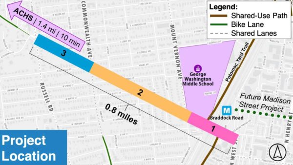
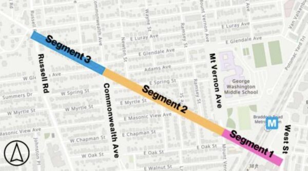
The Holland Lane Restoration Project has been in the works since 2024 and was completed; it includes repaving and reducing lanes on each side of Holland Lane, new pavement markings, flexible bollards, pedestrian signals and two-way bike lanes. The Alexandria Police Department also announced a high-visibility speed enforcement campaign for Holland Lane, which connects Duke Street and Eisenhower Avenue.