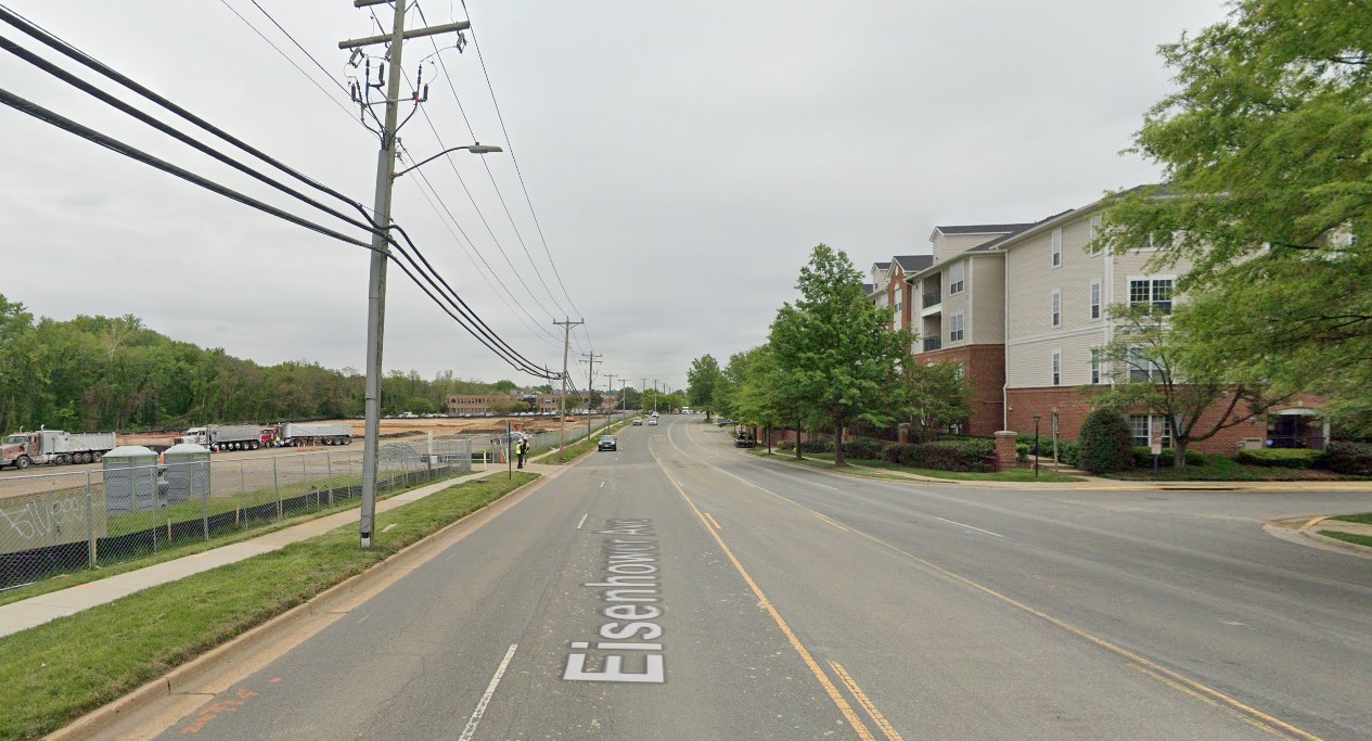
The Eisenhower Avenue-Mill Road project had one of the most bizarre approvals in recent city history — a project nobody on the City Council wanted but was too expensive to cancel.
Changes implemented earlier this year on Eisenhower Avenue were notably out of date, widening a roadway and creating a T-intersection at a time when the city is usually doing the opposite, but the City would have to pay back grant money already spent on the project if it were canceled.
A little over five months since the project was completed, Transportation Division Chief Chris Ziemann said the city has been trying to make the best of a project that no longer conforms to current transportation design.
One major problem is the project has been in the works for nearly 20 years.
“This project stems from the 2003 Eisenhower East Small Area Plan,” Ziemann said. “They were expecting development to happen faster than it did. They were expecting more traffic and a need to handle that a lot better, along with predicting a lot of office space to go in there.”
But while the opening of the Patent and Trademark Office (USPTO) in 2005, and later the National Science Foundation in 2017, spurred some redevelopment in the region, it wasn’t quite as much and wasn’t quite as quick as planners expected. Today, after the Covid pandemic, the USPTO is downsizing its Carlyle office space.
Ziemann said the traffic study was done in 2009 and the design concept was approved in 2013, but the next year, the City came out with its Complete Streets Guidelines. Vision Zero came out in 2017.
“So, obviously, the design takes safety and multimodal access into account, but it’s not designed with Vision Zero in mind,” Ziemann said.
Ziemann said the project was plagued with numerous unexpected challenges.
“This project took a long time because there were a lot of unexpected things that popped up, like utilities and working with property owners on right of way took longer than expected,” Ziemann said. “This was approved by the City Council ten years ago.”
While the city has been implementing road diets on other streets and changing roadways to prioritize transit, in many ways the Eisenhower Avenue and Mill Road intersection changes take an old-school approach of road widening to accommodate more traffic.
The project added a second left-turn lane from westbound Eisenhower Avenue onto Mill Road and a new lane onto Mill Road.
The roundabout at Eisenhower Avenue and Holland Lane was converted to a T intersection… even as the city reports say T intersections are more dangerous and, among the improvements to fix dangerous intersections, are conversions to roundabouts.
Ziemann said there’s some added context to Eisenhower Avenue and Mill Road that make the streets a little different from areas like Duke Street or Seminary Road.
“The roads where we are repurposing lanes and stuff like that, they’re not connected to interstates and not around 15-20 story buildings,” Ziemann said. “That’s a bit of the changing context.”
Still, Ziemann recognized that the project as-is isn’t necessarily how the city would approach the intersection if it was starting the project today.
“This project took a super long time, and it kind of reflects that too,” Ziemann said. “If we were starting from scratch, it might look different.”
Residents near the intersection shared images of crashes occurring in the newly redesigned intersection.
Should shock no one that the newly widened Eisenhower-Mill intersection is now less safe for all road users. The speeders are loving the big inviting drag strip the city created for them & drivers are more chaotic than ever. Thanks @AlexandriaVATES @AlexandriaVAGov pic.twitter.com/Mt6ZR7i4Qq
— Rebecca Tiffany (@rebeccajtiffany) October 3, 2023
Ziemann said the city uses annual crash data to monitor the impact of a project, and said that data won’t be in until sometime next spring.
“When we track it, generally we look at trends,” Ziemann said. “If there are a lot of crashes at one time or if there are certain things happening continuously, but — basically, since it was just finished in May — it’s too early to gather crash data.”
Regarding the crashes, Ziemann said any time there’s a change to a roadway, there’s a period afterward where drivers get adjusted to the changes.
Once that crash data comes in, Ziemann said the city will adjust plans as needed, but said those frustrated by the new design should temper their hopes the city might tear up the roadway and start from scratch again.
“As we monitor the safety and crash history in that area, we’ll definitely look to see if more improvements are needed and we’ll go from there,” Ziemann said.
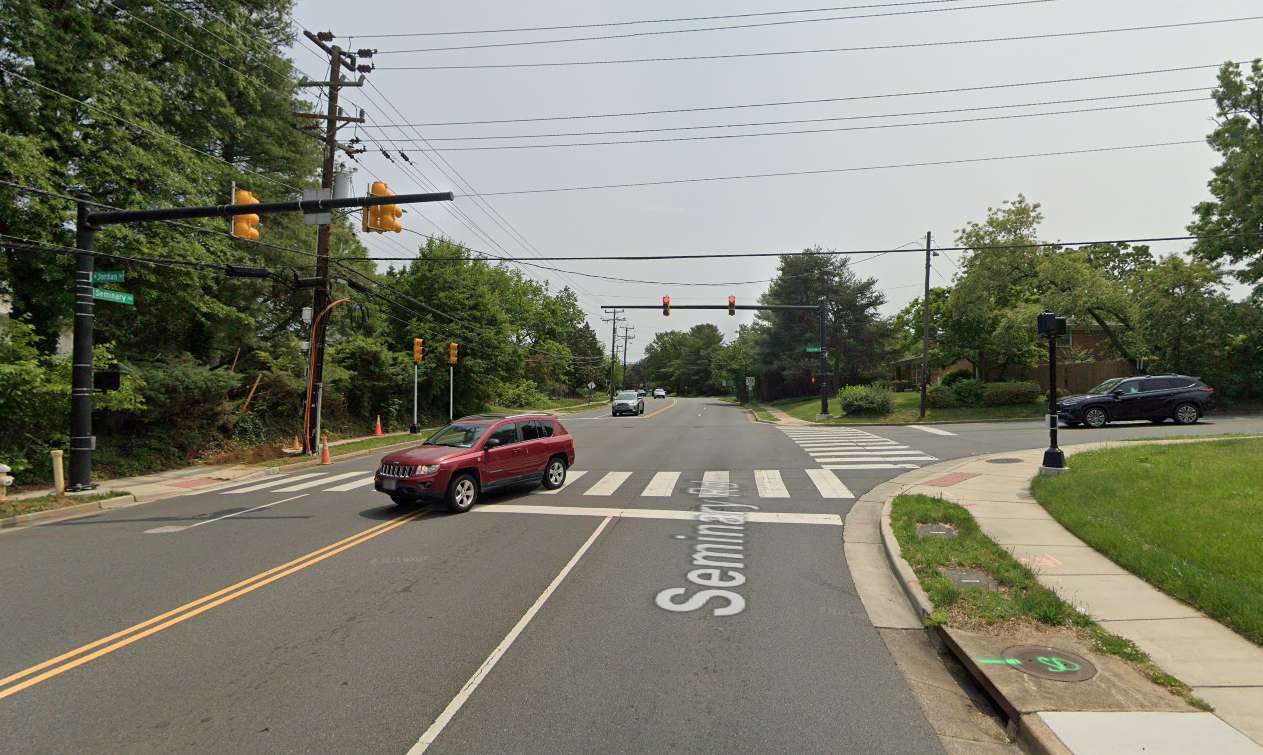
When a pedestrian walk signal comes on at a T-intersection, the light for turning vehicles comes on at the same time: meaning every vehicle is turning into a crosswalk that has an active walk signal.
A memo from Adriana Castaneda, director of Transportation and Environmental Services, concurred with the broader planning community: T-intersections are uniquely dangerous. Now, the City of Alexandria wants to make enhancements across the city’s 80 T-intersections to make them safer.
A roll-call consent calendar item at the City Council meeting tonight (Tuesday) is an application to the Commonwealth Transportation Board’s FY 2025 Virginia Highway Safety Improvement Program Systemic Safety Funding Program (VHSIP) to enhance safety and reduce crash severity at intersections.
“The City of Alexandria is focusing on the specific criteria that supports safety enhancements at its approximately eighty T-intersections,” Castaneda wrote in the memo. “T-intersections pose a unique threat to pedestrians crossing the street since all vehicles are turning through the crosswalk at the same time the pedestrian has a walk signal.”
Castaneda said she’s asking the city to apply for funding without requiring a local match.
“The VHSIP notified that localities may apply for funding for systemic treatments other than those that are pre-approved and those will be evaluated based on their benefit,” Castaneda wrote.
Image via Google Maps
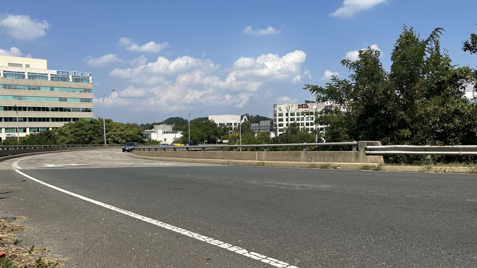
Good news Alexandrians, the plan is underway: our main route into Shirlington for the annexation plans is getting an upgrade.
The Virginia Department of Transportation (VDOT) said rehabilitation is underway for the Shirlington Circle south rotary bridge over I-395, which connects Shirlington Road to N. Quaker Lane.
According to VDOT, the project includes:
- Resurfacing the concrete bridge deck
- Closing deck joints
- Repairing steel beams
- Adding protective concrete barriers adjacent to piers
- Replacing bearings
- Cleaning and re-coating the bridge
- Upgrading guardrails adjacent to the bridge
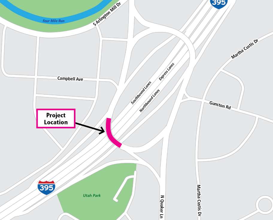
VDOT warned there may be daytime and overnight lane closures on the bridge, as well as overnight closures on sections of I-395.
The $5.5 million project is financed with federal and state funding, including State of Good Repair funds, according to VDOT.
The project is scheduled for completion in mid-2025.

Work is finally getting underway next week on a complete overhaul of the busy King/Callahan/Russell intersection.
Work is expected to start the first week of October. Drivers going through the intersection could expect delays and limited access from 9 a.m.-6 p.m. Monday through Friday, and from 9 a.m.-6 p.m. on Saturday. Residents and commuters are warned to plan for potential delays.
“The City of Alexandria will begin construction on the King/Callahan/Russell Intersection Improvements Project starting in October,” Project Manager Reginald Arno said in a letter. “This project will redesign the intersection of King Street, Callahan Drive, and Russell Road to enhance mobility, access, and safety for all roadway users, as well as improve access to Alexandria Union Station and King Street Station.”
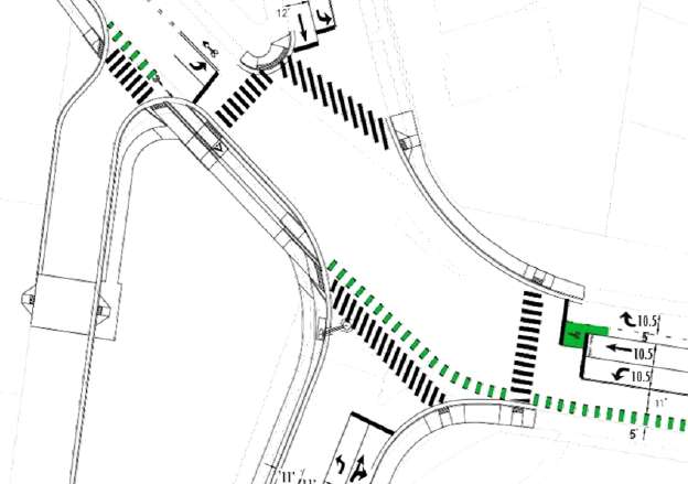
Work on the intersection is scheduled to run through spring 2024.
Plans for the intersection include upgraded sidewalks, new crossings, and a new bike lane. According to a report, changes include:
- A new pedestrian crossing of King Street on the west side of the intersection
- Safer, more direct pedestrian crossings across King Street and Callahan Drive
- Removal of the slip ramp to reduce vehicle turning speeds and improve safety
- Removal of the concrete median islands
- Converting the Masonic Temple service road from two-way to one-way southbound
- A leading pedestrian interval (LPI) for all crossings, a safety measure that provides a head-start for people using the crosswalk
- Upgraded sidewalks to provide more space, accessible ramps, and connection to the steps that lead to the Masonic Temple
- Bike lanes on King Street to help people biking safely position themselves and navigate the intersection
- New pedestrian signals where they are currently missing
- Signal timing improvements to minimize delay
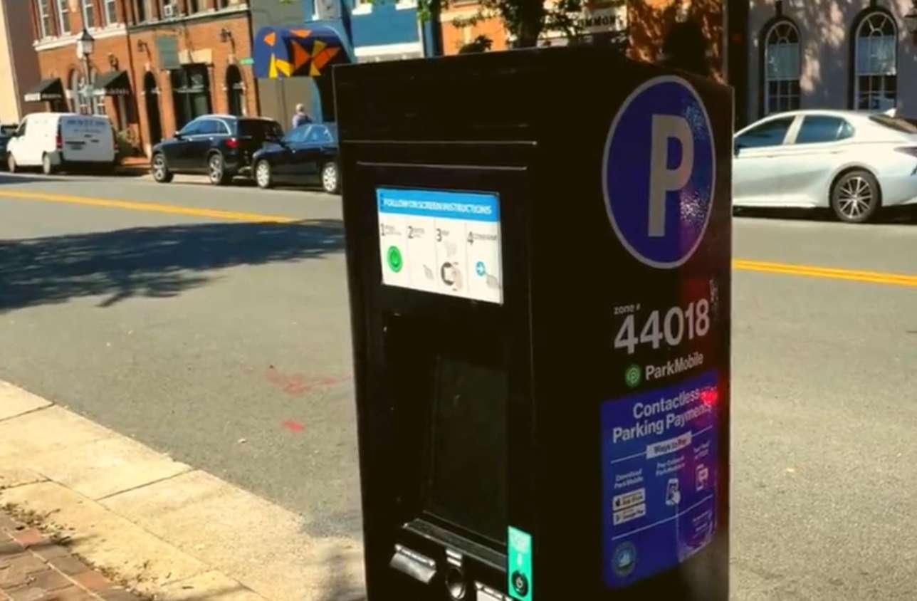
New parking meters are being installed in Alexandria to ditch the old pay-and-display system.
Earlier this year, the city started moving away from pay and display systems with new pay-by-plate meters installed in the Carlyle and Potomac Yard neighborhoods. But now, those meters are starting to get a citywide expansion to replace the older systems.
Users can either use the parking app ParkMobile or input their license place information into the kiosk directly.
“New parking meters are coming to Alexandria early fall 2023,” the city’s website said. “Simply enter your license plate number and pay using the kiosk or ParkMobile app.”
Parking in Alexandria just got easier! New parking meters are being installed that no longer require you to pay and display the receipt on your windshield. Have you seen these new meters around town?
Learn more about parking in Alexandria >>https://t.co/ILmigtOKZ3 pic.twitter.com/gvEVOYqmqs
— Alexandria Transportation & Environmental Services (@AlexandriaVATES) September 21, 2023
It’s been an uncharacteristically busy day for King Street news.
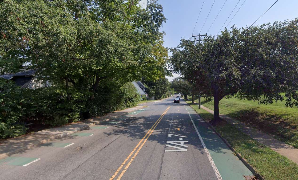
The street could be getting new bike lanes and a sidewalk on the north side of the road in a few years. In the short term, however, a section of the street is getting resurfaced and some stormwater improvements this month.
King Street from Janneys Lane to Russell Road — the stretch west of the Metro station — is being resurfaced this month. West Glebe Road is also being resurfaced from Valley Drive to the Arlington border.
Repaving work started yesterday (Monday) and will run through Saturday, Sept. 30.
“Businesses and residents whose streets are scheduled for resurfacing receive advance notice of paving work — typically by displayed project signs and/or letters,” the city said in a release. “Temporary ‘No Parking’ signs will also be posted before work begins. Please be sure to observe these signs to avoid tickets and potential towing of vehicles.”
Along the same stretch of King Street, new storm inlets are being installed. Storm inlets are also being installed on the 100 block of Monroe Avenue and the 1600 block of Duke Street.
Image via Google Maps
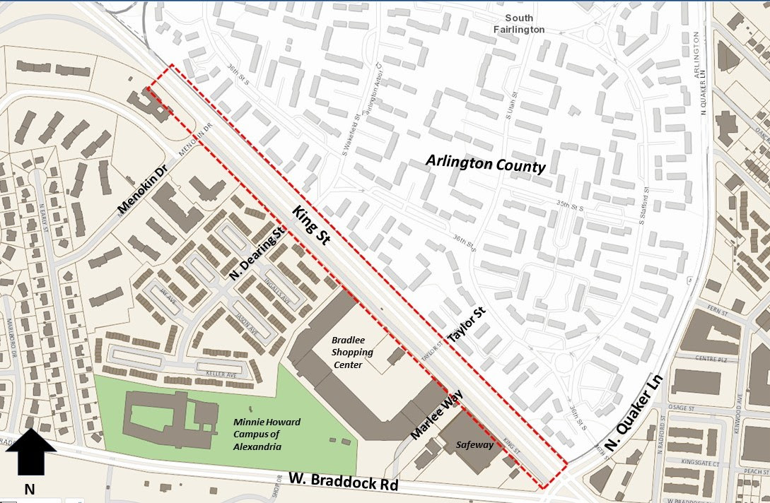
Some changes could be coming to the section of King Street near the Bradlee Shopping Center, but they’re at least four or five years away.
The City of Alexandria announced today that it will start a King Street-Bradlee Safety and Mobility Enhancements Project later this month. The project will look at potential improvements to King Street just northwest of Quaker Lane along the Bradlee Shopping Center.
A release from the City of Alexandria noted that the area was previously identified as a priority location for ‘enhanced bicycle facilities’ — likely an extension of the bicycle lanes along King Street to the southeast — and more sidewalks. Along this stretch, there is no sidewalk on the northern side of King Street.
“The Alexandria Mobility Plan identified this corridor as a priority location to install enhanced bicycle facilities and additional sidewalks to complete critical gaps in the existing transportation network,” the release said. “Safety improvements will help the City reach its Vision Zero goal of eliminating all fatal and severe crashes.”
An online survey is set to launch on Wednesday, Sept. 20, to collect feedback from those who have walked, bike, driven or taken transit through the area.
This section of King Street sees significant pedestrian traffic from the nearby Minnie Howard and King Street campuses of Alexandria City High School. The nearby streets were a topic of concern during discussions about getting students back and forth between the two campuses — though a direct route from one school to the other wouldn’t touch the project area in question.
The project’s website said community engagement is set to kick off this fall, with design starting next spring and running through to spring 2027.

The City of Alexandria has a new Director of Transportation and Environmental Services to oversee some of the biggest ongoing projects in the city.
City Manager Jim Parajon appointed Adriana Castañeda to lead the department.
“Castañeda joins the organization from the City of Tracy, California, where she oversaw housing, transit, airport, and economic development services as the Director of Mobility and Housing,” the city said in a release. “Previously Castañeda served the City of Dallas, Texas as its Director of Bond, and Construction Management, where she oversaw the capital infrastructure activities of nearly 200 staff and a $23 million operating budget.”
Parajon also joined the City of Alexandria from Texas back in 2021.
Alexandria’s Department of Transportation and Environmental Services has become one of its most high profile sections in recent years thanks to large-scale projects aimed at improving transit infrastructure, stormwater capacity and more.
The release said Castañeda will be responsible for transportation systems and infrastructure, emergency weather planning, and refuse collections for the city.
“The City is set to embark upon new and necessary transportation and infrastructure projects,” said Parajon. “Ms. Castañeda’s expertise and leadership will be exceptionally valuable to our ability to meet the needs of our residents effectively and efficiently.”
While much of the discussion about transportation changes has been focused on Duke Street recently, the city is starting to turn its eyes to Eisenhower Avenue.
The City of Alexandria is now accepting public comment on transportation issues and needs along Eisenhower Avenue. The survey is part of a process aiming to evaluate mobility, access and safety needs along Eisenhower Avenue.
According to the project website:
The expected outcomes of the study are grant applications to fund identified improvements in the program. The project will keenly focus on issues such as the high crash rate between Van Dorn Street and Eisenhower Ave Connector, poor connectivity and accessibility for pedestrians and cyclists near Hensley Park, Holmes Run Trail, and Lake Cook, as well as addressing future demand concerns in the Eisenhower east section of the corridor. The State and City expect to complete this study by Summer 2024.
Changes for the street have been in consideration for years, including adding protected bike lanes.
There’s been little rush to make those changes, the street is relatively sparsely populated and mostly known for industrial zones and isolated islands of commercial development, but that could be changing as the Victory Center is replaced with a new townhouse development and more development comes to the east end of the street.
A feedback form with questions broken up into sections along the roadway.
The city is finishing up an existing condition review, scheduled to run from July to October, with preliminary recommendations coming out at the end of that process. More evaluation and refining of recommendations is scheduled to run through March and into a grant application sometime in summer 2024.
What is your experience on Eisenhower Avenue? The City is accepting public comments on transportation issues and needs on Eisenhower Avenue through September 17. For information on this project, and to complete the feedback form, visit https://t.co/haVjezpNfJ pic.twitter.com/rVZFBT74Ig
— Alexandria Transportation & Environmental Services (@AlexandriaVATES) August 30, 2023
Image via Google Maps
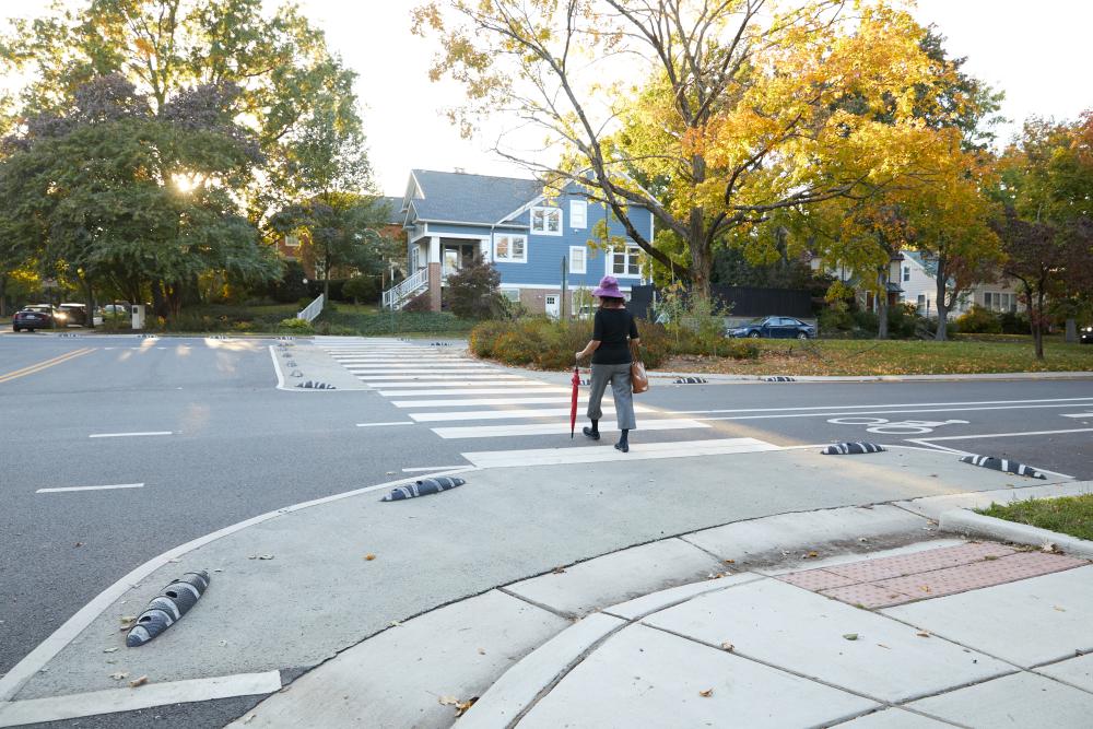
The City of Alexandria is considering some improvements to sidewalks to make it easier and safer for students to walk to school.
The City is considering curb extensions, which bump out the sidewalk at corners or mid-block to shorten the crossing distance, make pedestrians more visible, and slow turning vehicles. Curb extensions were recommended in the city’s Complete Streets Design Guidelines.
A walk audit conducted in 2017 at 13 schools also recommended curb extensions at multiple intersections.
The city is considering multiple extensions near four different schools:
- Jefferson-Houston PreK-8 School: N. West Street and Princess Street
- Mount Vernon Community School: Commonwealth Avenue’s intersections with Uhler Avenue, Mt. Ida Avenue, Groves Avenue and Forrest Street
- Patrick Henry K-8 School: N. Jordan Street and Taney Avenue
- Samuel Tucker Elementary School: Cameron Station Blvd
The city is developing a grant application to fund the design and construction of the curb extensions. A survey is available online and the grant application deadline is later this fall. If the funding is approved, the design work could start next year, with construction from 2025-2026.
The City is seeking public input on curb extensions near 4 schools in Alexandria, which would make it much safer for children to walk to school.
Very quick survey here:https://t.co/CdeFXxiX3G
— Alex Goyette (@Alex_Goyette) August 11, 2023


