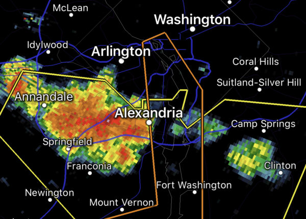
Alexandrians are being told to seek shelter indoors immediately.
“The National Weather Service has issued a Severe Thunderstorm Warning for Alexandria,” the city said in a release. “Seek indoor shelter immediately.”

Alexandrians are being told to seek shelter indoors immediately.
“The National Weather Service has issued a Severe Thunderstorm Warning for Alexandria,” the city said in a release. “Seek indoor shelter immediately.”
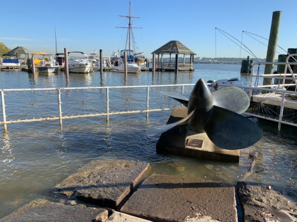
The National Weather Service (NWS) is warning that low-lying areas of Alexandria could see as much as two or three feet of tidal flooding for the next few days.
In a coastal flood warning, the NWS said from tonight (Thursday) at 8 p.m. until 2 p.m. on Saturday (Oct. 30), high tides could flood parts of the city — particularly along the waterfront.
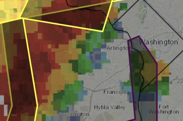
The National Weather Service has issued a flash flood warning for Alexandria.
“Avoid small streams and do not drive through water on roadways,” the city’s emergency services said.
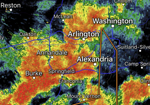
(Updated at 10 p.m.) The Alexandria Fire Department is responding to nearly a dozen calls throughout the city as it remains under a Flash Flood warning until 2:30 a.m.
“Right now we are on 11 different calls for public service for water-related emergencies,” Alexandria Deputy Fire Chief Brian Hricik told ALXnow.”It does not appear that any of them are people trapped in vehicles.”
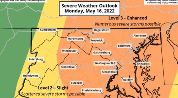
Alexandria is under a Severe Thunderstorm Warning, as a strong storm bears down on the area.
From the National Weather Service: