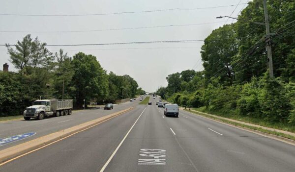
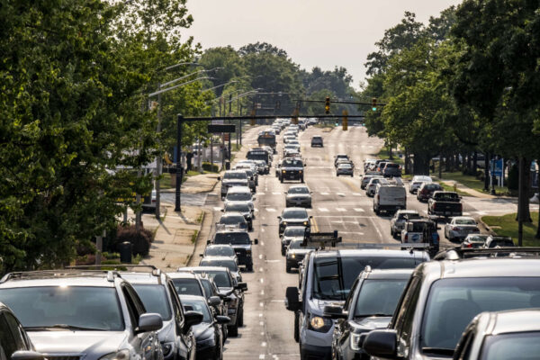
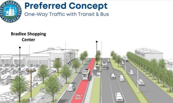
Post Content

Alexandria is seeking community feedback on a series of changes to South Pickett Street in the West End, including new pedestrian safety measures and protected bike lanes.

The project would cover S. Pickett Street from Duke Street down to Edsall Road. That route along the West End Village shopping center, Hillwood Condominiums, and ends near Samuel Tucker Elementary School.

“Today, South Pickett Street serves fast-moving vehicular traffic, has very few pedestrian crossings despite a robust crossing demand, and has no bicycle facilities,” a city report said. “This corridor has gradually been redeveloping into a higher-density neighborhood conducive to non-automobile travel, but the existing street design is challenging and hostile for people walking, biking, and taking transit.”

The road, currently four lanes, could be cut to two lanes for car traffic, one center-running turn lane, and a protected bike lane on each side of the street.

Proposed new design for S. Pickett Street (image via Google Maps)

The report said “no significant differences in traffic operations” was expected based on a traffic analysis.

Other proposed changes include:

  • Dedicated center turning lane
  • Posted speed limit reduction to 25 mph
  • New pedestrian crossings at key locations
  • Traffic calming measures
  • Upgrades to pedestrian ramps
  • Lead Pedestrian Intervals and no turn on red restrictions at signalized intersections

Feedback can be submitted online until May 5. A virtual community meeting on the project is scheduled for Thursday, April 25 at 7 p.m. The meeting ID is 968 5930 1979 and the passcode is 968 5930 1979.

Following community feedback, the city said recommendations will be sent to the Traffic and Parking Board later this spring or this summer.

Image via Google Maps

33 Comments
ALXnow editor’s work from home setup (staff photo by Vernon Miles)

Of the 96,993 working Alexandrians, 30% of them work from home (30,015 people), according to the US Census.

United States Census data collected from 2022 provides a detailed breakdown of how Alexandrians travel to work.

The majority of workers, 51% of them (50,019 people), drove to work alone, with only 4,479 people reporting carpooling.

The least used category of travel was taxicab, motorcycle, bicycle or “other means” at 2.3% of workers (2,303 people), slightly less than the 2,345 people who walked to work.

The census estimated that 7,832 Alexandrians took public transportation to work in 2022. While this is only 8% of the workforce, the city was still included in a viral post about 21 cities with a population over 100k people where over 10% of residents take public transit to work.

31 Comments
Van Dorn Street (image via Google Maps)

If Alexandria wants the transit corridors it dreams of, Planning Commission Chair Nathan Macek said it’s going to need to do more to secure federal funding.

In a budget discussion at the Planning Commission meeting last week, Macek noted that there is “no plan to pursue federal money” for two of the major transit corridors in the city budget.

Transitway corridors are areas where the city is hoping to implement “enhanced transit services” like bus rapid transit, a streetcar, dedicated bus lanes and more. Corridor B is the Duke Street / Eisenhower Avenue corridor. Corridor C is the Van Dorn Street / Beauregard Street corridor.

Macek said in the meeting that the funding set aside for transit development on those corridors is all local and regional funding.

“I will make, at every call, every opportunity I have, the call that we should be pursuing federal money for these projects,” Macek said.

Macek said he has concerns that the city is missing out on a chance to make those transit on those corridors better.

“My concern with the way we’re deploying BRT is we’re so content to make it happen with local and regional, and we’re not pursuing federal money that could help make this a real, functional, better bus rapid transit,” Macek said. “Totally missing that opportunity to pursue federal funds that could help us address the issues we have in these corridors.”

Staff told Macek at the meeting that one of the limits of the budget is it doesn’t show what avenues are being pursued, just what’s secure in the budget. Staff said efforts are underway to lock down federal funding for transit corridors.

Macek noted the Van Dorn Street Corridor in particular, which is seeing an upswing in new projects like the Vulcan property development, could benefit from federal funding for transit needs and possible widening.

“When we’re only working with local and regional money, we necessarily limit the scope of what we can accomplish because of that,” Macek said.

Photo via Google Maps

13 Comments
Rendering of center-running bus lanes on Duke Street (image via City of Alexandria)

Alexandria’s bus rapid transit (BRT) ambitions for Duke Street are getting a federal boost.

The Federal Transit Administration announced that Alexandria will receive $550,000 in grant funding for transit-oriented development planning on the Duke Street corridor.

Last year, the City of Alexandria voted to move forward with dedicated bus lanes on portions of Duke Street, part of an effort to make the material roadway more transit-friendly.

According to the grant:

The city of Alexandria will receive funding to plan for TOD along the proposed Duke Street Bus Rapid Transit corridor. The planned BRT corridor will provide transit access along an approximate 3.7-mile stretch of Duke Street, connect two ends of the City from the planned West End (former Landmark Mall) mixed-use development to the King Street Metrorail Station and Alexandria Union Station, which will connect Duke Street to regional transit and commuter rail.

The project is estimated to cost a total $87 million. Construction is scheduled to start sometime in 2026.

17 Comments
Holland Lane project (image via City of Alexandria)

Holland Lane isn’t one of the longest or most-used streets in Alexandria, but it’s a major connection between the Old Town and Carlyle neighborhoods that may be getting a slight overhaul soon.

The City of Alexandria is currently gathering community feedback on plans that include, among other things, a bike lane on Holland Lane.

The street, which runs from Eisenhower Avenue up to the Whole Foods on Duke Street, is four lanes for most of its length and five at the Duke Street intersection.

Holland Lane project (image via City of Alexandria)

The street is in a highly dense area where a City presentation said up to 29% of drivers speed past the 25 mph limit by 5 mph or more. The City said there have been 13 crashes on Holland Lane since 2018 and six of those involved people walking, all of which resulted in injury.

There are four options presented for the project, but other than the no-build option, all of them involve installing bike lanes on one or both sides of the street.

Detailed design for the project is scheduled for summer-fall this year with implementation sometime next year.

19 Comments
A pedestrian tries to cross Duke St. at N. Jordan St. (Staff photo by Jay Westcott)

The Vision Zero goal of zero roadway deaths and severe injuries is daunting, but the City announced that it closed 2023 with zero traffic fatalities.

In a release, the Department of Transportation and Environmental Services (T&ES) noted that one year with zero fatalities does not a trend make or mean that the city should roll out the Mission Accomplished banner.

“For the first time since the City of Alexandria’s Vision Zero goal of eliminating roadway deaths and severe injuries was adopted in 2017, the City has ended the year with zero fatalities,” T&ES said in the release. “While this does not necessarily indicate a trend or suggest that the City’s goal has been accomplished, it is a major milestone that demonstrates Vision Zero is achievable.”

T&ES said there were still “over a dozen severe injury crashes” last year.

According to the release:

The people affected by these crashes are parents, children, spouses, siblings, friends, neighbors, and colleagues, and these crashes can bring lifelong pain, disability, and trauma. Some victims of severe crashes may also succumb to their injuries later on. In at least one case in 2023, a crash victim is still fighting for their life in an intensive care unit. Roadway safety improvements can help prevent these kinds of tragedies.

10 Comments
Presentation on RAISE Planning Grant application (image via City of Alexandria)

The City of Alexandria wants federal help to make the stretch of Seminary Road northwest of I-395 safer.

The City Council is slated to review a grant application to the United States Department of Transportation for the Rebuilding American Infrastructure with Sustainability and Equity (RAISE) grant program for up to $1 million to conduct a planning study on Seminary Road between Library Lane and North Beauregard Street — right in front of Southern Towers.

“Nearly all of the intersections along this segment of the Seminary Road corridor have been identified for safety enhancements as part of the Vision Zero program, Safe Routes to School Walk Audits, community feedback, and the Alex West planning process,” the memo from Adriana Castaneda, director of Transportation and Environmental Services, said. “These intersections cannot be addressed in isolation; a more holistic assessment of the corridor is needed to determine how to mitigate the issues and understand their impact on traffic.”

The memo said the goals of the new transportation plan would be promoting alternative modes of transportation, such as walking, biking and public transit, along with improving accessibility and reducing congestion.

The planning would also include a traffic study, analysis and design alternatives for the Seminary Road interchange.

The grant requires a 20% local match for a maximum of $200,000 from the city. The city is offering to make a 25% match of $250,000 to make the proposal more competitive.

“The City anticipates fulfilling this requirement with developer contributions previously secured for this area,” the memo said.

The grant application is scheduled for a vote at the City Council meeting on Tuesday, Feb. 27.

The memo notes that the funds awarded through the grant must be obligated by September 2028 and fully spent by September 2033.

7 Comments
Sanger Avenue (image via Google Maps)

Sanger Avenue, a West End road that runs from William Ramsay Elementary School to I-395, could be getting some safety and cycling upgrades.

A memo (page 12) from Department of Transportation Deputy Director Hillary Orr to the Transportation Commission included a note that the street could receive some improvements as part of an upcoming paving project.

“City staff is working on providing safety and cycling mobility improvements along Sanger Avenue as part of the upcoming paving project,” Orr wrote. “The focus is on providing additional and safer pedestrian crossings, daylighting intersections due to pedestrian crashes and vehicular angle crashes and providing more buffer space for pedestrians and cyclists under the I-395 bridge near Van Dorn Street.”

Orr said that more information will be shared with the community and a presentation will go to the Traffic and Parking Board sometime this spring.

Image via Google Maps

4 Comments
Opening of the Potomac Yard Metro station (staff photo by Jay Westcott)

One of the biggest concerns about the Potomac Yard arena has been the transportation plan: how can the city effectively get arena traffic to and from Potomac Yard?

A transportation study by consultant Kimley-Horn outlined both challenges and possible solutions to transportation concerns.

The study said that the current Potomac Yard Metro station has several pinch points that will be over capacity after events at the arena. The study showed that nearly every point on the station, from the platforms to the ticket machines, will be over capacity after events with crowding and excessive queuing.

The study said improvements to the station could cost anywhere between $35 to $70 million, with transit service enhancements costing between $2.5 to $7.5 million annually in additional post-event Metrorail trains, increased bus service and more.

“With investments in transit service, multimodal infrastructure, and technology, the development will achieve desired non-auto mode split of at least 50% within the stated budget,” the report said.

A presentation on the study is available online and mayor Justin Wilson said the City of Alexandria will host a community conversation with Kimley-Horn next week about transportation planning.

The event is virtual only and will run from 7-8:30 p.m.

Attendees can register online to attend.

28 Comments

The proposed Potomac Yard arena could hold up to 20,000 people and those attendees have to get to the arena somehow.

A presentation prepared by the Virginia Department of Transportation (VDOT), City of Alexandria and Monumental Sports & Entertainment provided a glimpse at plans to handle that traffic.

The presentation noted that 300 events are planned each year, 40 of which will coincide with weekday rush hour. Of those, 50% are expected to get there by driving or through rideshare, while 50% are expected to get there via transit, bike or walking.

The peak need, the presentation said, is handling 2,800 extra cars.

For car traffic, the presentation said the plan is to:

  • Maximize Route 1 and Glebe Road throughput and efficiency
  • Minimize traffic through local streets
  • Create dedicated rideshare zones on and off-site
  • Ensure parking is on-site and protect nearby neighborhoods

The 2,800 new peak car trips account for around 6% of weekday volume on the road. The presentation said improvements planned for Route 1 include:

  • Expanded turning lanes to reduce backup
  • Dedicated through lanes for commuters
  • Dedicated turn lanes separating game day traffic from commuters and locals
  • Coordinated signals at intersections to move arena traffic off Route 1 and into the site
  • Dedicated parking on-site with queuing off Route 1

Meanwhile, the plan said satellite parking sites at the Huntington and Eisenhower Metro garages to the south and Crystal City or Pentagon City to the north will take some of the traffic, with attendees then taking Metro on that “last mile” to the arena.

The presentation said dedicated rideshare zones and queues are part of the plan for the site, similar to how that drop-off is separated at airports.

One of the biggest lingering questions has been how the Potomac Yard Metro Station — which General Manager Randy Clarke said cannot handle arena capacity — would hold up as one of the central pillars of the transportation plan.

The presentation outlined plans to add capacity to the station, with:

  • A widened bridge
  • Additional escalators
  • Added fare gates to cut down on ‘pinch points’ at the station

Lastly, the plan said that eventually Water Taxi access could be added out in the Potomac River and a new Virginia Railway Express station could be built nearby to reduce the burden on the Metro station.

92 Comments
×

Subscribe to our mailing list