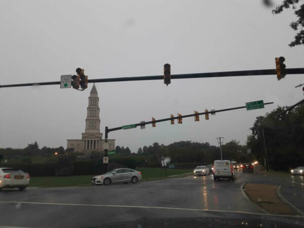
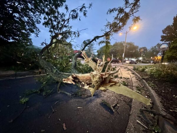
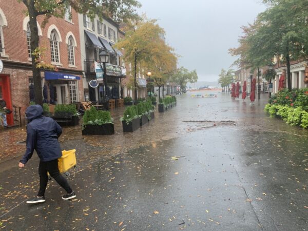
Alexandrians should brace for a stormy weekend.
Rain is likely to kick off tonight after 11 p.m. and there’s a good chance it will continue through the weekend as a tropical storm approaches Saturday night, according to the National Weather Service.
Tropical storm conditions are possible Saturday night. Between 1 and 2 inches of rainfall is expected.
“Widespread rainfall amounts of 2 to 4 inches are expected, with localized amounts up to 5 inches possible,” the National Weather Service said in an advisory today. “This may result in isolated instances of flooding, especially for low lying and flood prone areas. The heaviest rain is most likely to occur Saturday into Saturday night.”
Some of that rain is expected to continue into Sunday, with showers before 8 a.m.
The storm’s already had an impact on some Alexandria events. The first “Rock the Block” for the Eisenhower Corridor is being postponed thanks to the storm.
Sandbags are also being distributed for Old Town Businesses today from 2-3 p.m.
In response to the Coastal Flood Watch issued for the Alexandria area, T&ES crews will be distributing sandbags at the intersection of Prince Street and Union Street, from 2 pm to 3 pm. pic.twitter.com/MUqj3fAoUZ
— Alexandria Transportation & Environmental Services (@AlexandriaVATES) September 22, 2023

(Updated on Sept. 21) This Saturday’s first-ever Eisenhower Rock the Avenue Block Party to promote the Eisenhower Valley has been postponed due to a rainy forecast.
“As of this morning, it is still calling for 100% heavy rain and high wind,” event organizers wrote in an email. “Given these predictions, it would be very hard to hold an event with these miserable conditions.”
Eisenhower Partnership and SaltBox are hosting the inaugural event, which was to include a pop-up Cider Garden hosted by Lost Boy Cider, food and products from businesses on Eisenhower Avenue, as well as kid-friendly activities and live music.
A replacement date has not been announced.

At the risk of flooding readers with stormwater stories today, locals recovering from last night’s flooding should be aware there’s a chance for more tonight.
A flood watch is different from a flood warning, but it’s of particular note coming to quickly after the last storm.
Important distinctions https://t.co/VOUd0F4KYz
— DrainALX (@DrainALX) August 15, 2023
The City of Alexandria said there could be up to two inches of rainfall with excessive runoff in flood-prone locations around town.
The National Weather Service has issued a Flood Watch for the City of Alexandria today until 8 p.m. Conditions include up to 2 inches of rainfall, and excessive runoff in flood-prone locations. For more information, visit https://t.co/6vT94DbjgO. #AlexandriaVA https://t.co/1hBSdDKecQ
— AlexandriaVAGov (@AlexandriaVAGov) August 15, 2023
The flood watch, ironically, overlaps with the start of a meeting about putting more resources into a flood mitigation grant program.
If you’re looking for something to tide you over until the weather passes, Port City noted that it has cases of Derecho beer in stock — a throwback to an interesting bit of local stormy brewing history.
Enjoying all the storms we’ve been having?
We still have cases of our Derecho beer in stock for a limited time!
— Port City Brewing Co (@PortCityBrew) August 15, 2023

Update at 6:10 p.m. — There are several outages reported around Alexandria due to the storm with around 2,000 total customers affected around the city. The largest outages are currently in the Lincolnia/Landmark areas.
The much-discussed storm has finally hit Alexandria.
The National Weather Service issued a Severe Thunderstorm Warning for Alexandria and nearby localities.
There are reports of downed power lines around the city. There are downed wires near the intersection of Route 1 and Cameron Street in Old Town, per scanner traffic.
Residents are being encouraged to go to their basements or to an interior portion of a sturdy structure, away from windows. The storms have been toppling trees and knocking out power over a large swath of Fairfax County prior to their arrival here.
The City of Alexandria is under a Severe Thunderstorm Warning until 6:45 p.m.⛈️
Use @AlexandriaVA311 or call 703.746.4311 to report any non–life threatening requests. For immediate emergency assistance, call 9-1-1.
To receive alerts, subscribe to: https://t.co/QOsaAGUkTE https://t.co/RU8gn7jJgO
— AlexandriaVAGov (@AlexandriaVAGov) August 7, 2023
https://twitter.com/patpend/status/1688667205406273537
More from the National Weather Service:
BULLETIN – IMMEDIATE BROADCAST REQUESTED
Severe Thunderstorm Warning
National Weather Service Baltimore MD/Washington DC
543 PM EDT Mon Aug 7 2023The National Weather Service in Sterling Virginia has issued a
* Severe Thunderstorm Warning…
* Until 645 PM EDT.
* At 543 PM EDT, severe thunderstorms were located along a line extending from I66 and I495 Interchange to 12 miles west of Stafford, moving east at 50 mph.
HAZARD…60 mph wind gusts.
SOURCE…Radar indicated.
IMPACT…Damaging winds will cause some trees and large branches to fall. This could injure those outdoors, as well as damage homes and vehicles. Roadways may become blocked by downed trees. Localized power outages are possible. Unsecured light objects may become projectiles.
* Locations impacted include… Arlington, Alexandria, Waldorf, Dale City, Bethesda, Bowie, Annandale, Clinton, Springfield, College Park, Fort Washington, Greenbelt, Fairfax, Langley Park, Fort Hunt, Vienna, Groveton, Forestville, Falls Church and Huntington.
PRECAUTIONARY/PREPAREDNESS ACTIONS…
A Tornado Watch remains in effect until 900 PM EDT for District of Columbia…central and southern Maryland…and northern Virginia.
For your protection move to an interior room on the lowest floor of a building.
Large hail and damaging winds and continuous cloud to ground lightning is occurring with these storms. Move indoors immediately. Lightning is one of nature’s leading killers. Remember, if you can hear thunder, you are close enough to be struck by lightning.
https://twitter.com/patpend/status/1688637003158441986
As Alexandria braces for a storm possibly rolling into town, several services around the city are shutting down preemptively.
All Alexandria Library branches are closing at 4 p.m. today due to “expected severe weather,” according to the library website.
All recreation programs and pools have been closed as well since 3 p.m. The Torpedo Factory Art Center is closing at 4 p.m. today, according to the city website. The Animal Welfare League of Alexandria is also closing at 4 p.m. today.
Alexandria’s DASH bus network tweeted that the main facility is closed to visitors due to the storm and locals are encouraged to “minimize travel during this time.”
In addition to the hazardous conditions warning this morning from the National Weather Service, much of the region is also under a Tornado Watch.
Heads up ⛈️: Alexandria may experience severe thunderstorms and high winds from 4 – 8 PM. We advise riders to minimize travel during this time, as DASH service may be disrupted by these weather conditions. https://t.co/Mah4xIoaPf
— DASH Bus (@DASHBus) August 7, 2023
Due to potential severe weather, the City of Alexandria will shift to virtual operations today, Aug. 7, at 4pm.
In-person facilities and programming held after 4pm are canceled unless otherwise stated. Cooling centers will remain open. Stay informed: https://t.co/6vT94DbjgO. pic.twitter.com/qlkcgWVHDI
— AlexandriaVAGov (@AlexandriaVAGov) August 7, 2023
A very dangerous day is ahead for the DMV with a very rare level 4 out of 5 risk for severe weather. Destructive damaging winds and several tornadoes are the primary threats along with hail & flooding.
Take today very seriously and have multiple ways to get alerts. #vawx #mdwx… pic.twitter.com/DtVZv7CWiv
— Washingtonian Weather Geeks (@WashingtonianWx) August 7, 2023
Last night’s storms might only be the start, according to the National Weather Service (NWS).
The city has had a rainy few weeks and now, the NWS says there’s a “hazardous weather outlook” in effect today and tonight for much of the region. NWS said the primary threat is damaging winds, but other threats include possible tornadoes and large hail.
“Numerous severe thunderstorms are expected to develop this afternoon and evening,” the NWS said. “Damaging winds will be the primary threat, some of these winds may become locally destructive. Additionally, a few tornadoes and large hail are possible. Isolated to scattered instances of flooding are also possible.”
The forecast calls for scattered showers and thunderstorms between 2-5 p.m.
“Scattered showers and thunderstorms between 2 p.m. and 5 p.m., then showers and possibly a thunderstorm after 5 p.m.” the forecast said. “Some storms could be severe, with damaging winds and heavy rain. High near 91. South wind 9 to 13 mph, with gusts as high as 20 mph. Chance of precipitation is 80%. New rainfall amounts between a quarter and half of an inch possible.”
That’s expected to continue tonight from 8 p.m.-2 a.m. with heavy rainfall, but the good news is it’s expected to be partly sunny tomorrow and Wednesday.
(Updated 1:25 p.m.) Alexandria is still clearing downed trees and in the wake of Saturday’s severe storm.
No one was reportedly injured in Saturday’s storm, which cut off power to an estimated 15,000 residents. As of Monday at around noon, there were still 131 households without power throughout Alexandria, according to Dominion Energy.
Some residents say they haven’t gotten a response from the city after a large tree fell through three properties in the 300 block of Queen Street.
“We can’t get the city out here one block from City Hall on a tree that’s city property, covering a city sidewalk on top of a city sign and over a city road,” said Scott Corzine on Queen Street. “We need somebody to take responsibility from the city to tell us if they are going to come take this tree down and this hazard to the community. We’re waiting to hear from someone and their response has been underwhelming to say the least.”
The street has since been partially closed for tree removal.
The road at 300 block of Queen St between Royal and Fairfax), will likely be closed into Monday evening for tree debris removal. Crews are currently conducting removal operations and coordinating with Dominion to restore power once tree removal operations conclude. pic.twitter.com/WlV5JBSr4I
— RPCA, Alexandria VA (@RPCA_AlexVA) July 31, 2023
The city said debris, down traffic signals, and other issues can be reported to the city by calling 703 746 4444 or contacting Alex311.
We have over 17K @DominionEnergy customers presently experiencing an outage scattered all over the City.
Report outages at 866-366-4357 or online at https://t.co/P7thQdZmld
There are also many trees down around the City.
Please report to 311 online (https://t.co/Vtsi3JkQj7). pic.twitter.com/1kFwXg7A2B
— Justin Wilson (@justindotnet) July 29, 2023
We are now down to just under a thousand Alexandrians without power.@DominionEnergy has indicated that the “vast majority” should be restored by 11PM tonight.
Stay cool!
— Justin Wilson (@justindotnet) July 30, 2023
Cleaning up the City after a storm is a team effort! We are here to help by offering residents services to clear debris and yard waste through @AlexandriaVA311 #alex311 #alexandriava pic.twitter.com/k6DakeT8yD
— Alexandria Transportation & Environmental Services (@AlexandriaVATES) July 31, 2023
In response to yesterday’s storm, the City of Alexandria rapidly deployed staff to clear downed trees and other debris. These efforts are still underway. Read more at https://t.co/aGrCAXzNYC.
— AlexandriaVAGov (@AlexandriaVAGov) July 30, 2023
We encourage residents to continue to submit storm damage issues to @AlexandriaVA311 for tracking purposes. As crews continue to clear debris from roadways, please consider the following tips to help us respond as quickly as possible. MORE INFO >> https://t.co/0YJf6jid7e pic.twitter.com/znJDcfZlLY
— Alexandria Transportation & Environmental Services (@AlexandriaVATES) July 30, 2023
Good Wednesday morning, Alexandria!
☀️ Today’s weather: The weather forecast predicts a mostly sunny day with a high of around 91 degrees. Expect a calm wind in the morning, turning to a south wind at 6 mph in the afternoon. Wednesday night will be mostly clear with a low of about 75 degrees and a south wind ranging from 6 to 9 mph.
🚨 You need to know
The Little Theatre of Alexandria (600 Wolfe Street) opened its 90th season this week with “Freaky Friday,” the musical.
The play is based on the 1972 novel by Bridget Carpenter about an overworked mother who magically switches bodies with her teenage daughter.
A number of Alexandria residents are appearing in the show, including James Campione (playing Fletcher), Paul Caffrey (Mike), Naja Bates (Savannah) and Peter Fannon (playing several roles). The show was directed by Joanna Henry and produced by Luana Bossolo and Sherii Ratick Stroud.
It is optional for audience members to wear face masks.
The show runs until Aug. 12. Their upcoming program is the comedy “Two on the Aisle, Three in a Van,” which runs from Sept. 9 to Sept. 30.
📈 Tuesday’s most read
The following are the most-read ALXnow articles for Jul 25, 2023.
- Notes: Many federal employees who report to work in Alexandria are still mostly remote | ALXnow (3805 views)
- ACPS ignores Gov. Youngkin’s recommended policies on treatment of transgender students (2634 views)
- Severe Thunderstorm Watch and Flood Watch in effect until tonight in Alexandria (1029 views)
- Alexandria police seeking SUV allegedly linked to Monday’s fatal shooting (547 views)
📅 Upcoming events
Here is what’s going on today in Alexandria, from our event calendar.
- No events today. Have one to promote? Submit it to the calendar.

The National Weather Service has issued a Severe Thunderstorm Watch and Flood Watch for Alexandria that will be in effect until 8 p.m.
NWS says to expect isolated severe thunderstorms capable of producing damaging wind gusts, and that flooding is possible.
Isolated severe thunderstorms are also expected Thursday afternoon and evening, according to NWS.
“Multiple rounds of thunderstorms are possible this afternoon into this evening,” NWS reported. “Where multiple thunderstorms occur, rainfall totals on the order of one to three inches are possible in a short period of time.”
The Severe Thunderstorm Watch includes D.C., Arlington, Fairfax and Prince William Counties as well as Falls Church, Manassas Park, Manassas and the City of Fairfax.
The weather will turn hot on Thursday and Friday, with the heat index expected to reach between 105 to 110 degrees.
As the clouds this morning continue to erode, the focus will turn to the potential for showers and thunderstorms this afternoon/evening. Some storms could be severe and produce damaging wind gusts, large hail, and isolated flooding.
Have multiple methods to receive warnings! pic.twitter.com/C4J5azIQRH
— NWS Baltimore-Washington (@NWS_BaltWash) July 25, 2023
Thunderstorms are expected across the area this afternoon. Any stronger thunderstorms may be capable of producing damaging winds, large hail, and isolated instances of flooding. Heat and humidity will build into the area through the remainder of the week. pic.twitter.com/mAjLOUbLqq
— NWS Baltimore-Washington (@NWS_BaltWash) July 25, 2023

A Severe Thunderstorm Warning is in effect for Alexandria and the surrounding area until 3 p.m.
The National Weather Service reported a severe thunderstorm in Oakton at 2:11 p.m., and that residents should expect 60 mile-per-hour wind gusts and quarter-sized hail.
“Damaging winds will cause some trees and large branches to fall,” NWS said. “This could injure those outdoors, as well as damage homes and vehicles. Roadways may become blocked by downed trees. Localized power outages are possible. Unsecured light objects may become projectiles.”
NWS continued, “Cloud to ground lightning is occurring with this storm. Move indoors immediately. Lightning is one of nature`s leading killers. Remember, if you can hear thunder, you are close enough to be struck by lightning.”
Severe Thunderstorm Warning including Washington DC, Arlington VA and Alexandria VA until 3:00 PM EDT pic.twitter.com/yIwOq9WR4E
— NWS Baltimore-Washington (@NWS_BaltWash) June 27, 2023