The heat wave is back in Alexandria this week.
The National Weather Service issued a Heat Advisory for Alexandria from 11 a.m. to 8 p.m. Wednesday. The real-feel heat index could climb as high as 106 degrees.


The heat wave is back in Alexandria this week.
The National Weather Service issued a Heat Advisory for Alexandria from 11 a.m. to 8 p.m. Wednesday. The real-feel heat index could climb as high as 106 degrees.

If parts of Alexandria are feeling the heat more than others, heat islands may be to blame.
The temperature is forecast to be 100 degrees on Thursday (July 16), when more than 30 teams will fan out to identify the hottest areas across Alexandria, Arlington and Fairfax County. The teams from George Mason University’s Virginia Climate Center and Faith Alliance for Climate Solutions will monitor temperature and humidity variations at 30 locations as part of their “Urban Heat Island Mapping Project.”
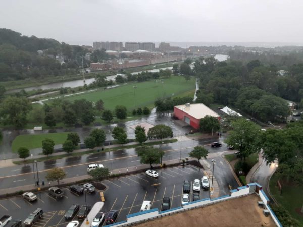
Alexandria is facing a flood watch today (Thursday) as storms with potential for downpours are in the forecast.
The National Weather Service issued the flood watch from 2-11 p.m. in Alexandria and other parts of the D.C. region. Forecasters say strong storms developing in the afternoon have the ability to create flash flooding.

The hottest stretch of the year so far has arrived in Alexandria.
The National Weather Service has issued a Heat Advisory from 11 a.m. to 8 p.m. Wednesday and Extreme Heat Watch from Thursday morning through Friday evening. Under the Heat Advisory, the real-feel heat index values could reach 106 degrees. The heat index, a combination of high temperatures and humidity, could climb as high as 112 during the Extreme Heat Watch.

A drought watch with a call for voluntary water conservation has been issued for the D.C. region today (June 3).
The Metropolitan Council of Governments Drought Coordination Committee recommended the drought watch, which increases coordination, communications and monitoring of the water supply. Precipitation, groundwater levels, streamflow and reservoir levels are factors in COG’s decision to declare a drought watch.

Alexandrians starting their gardening and other yard work may want to take precautions throughout the day and overnight.
The National Weather Service has issued a Freeze Warning from midnight to 9 a.m. Wednesday in Alexandria and surrounding areas. Forecasters say frost and freeze conditions could kill crops and potentially damage unprotected outdoor plumbing.
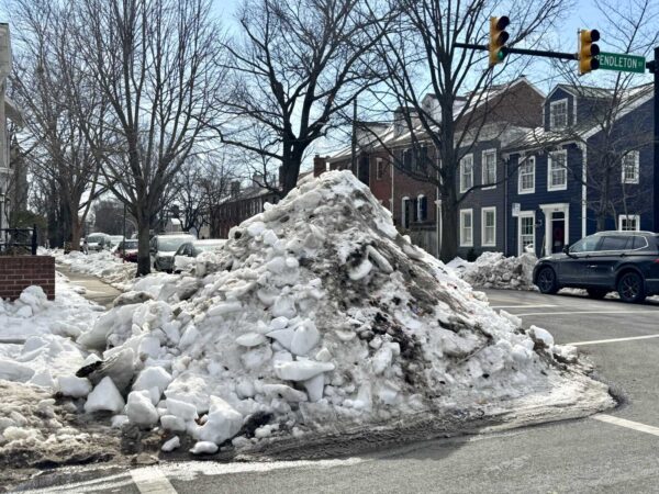
Alexandria spent $9.7 million on the Jan. 25 snow storm response, the bulk of which was attributed to outside contractors brought in due to the challenges of clearing “snowcrete.”
The winter storm brought about 8 inches of snow followed by hours of sleet and freezing rain that created a solid layer of ice on top. According to an after-action report presented to City Council Tuesday, contract services cost the city $8.4 million. City labor cost about $600,000, while materials, supplies, food and lodging for employees cost $700,000.
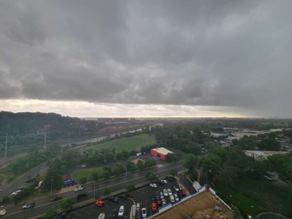
Alexandria and the rest of the D.C. region braced for severe thunderstorms today (Monday), but the tornado threat has declined. The National Weather Service has canceled the tornado watch for Alexandria as of 3:29 p.m. Monday.
The National Weather Service’s Storm Prediction Center now expects a slight to enhanced risk level from storms in the region. That’s down from the moderate risk level predicted earlier.

Alexandria City Public Schools will change up its schedule today (Monday) ahead of potential severe weather, including thunderstorms and possible tornadoes.
ACPS will dismiss students two hours early, and all afternoon and evening classes are canceled. The change comes after several regional school systems made their early dismissal decisions on Sunday.
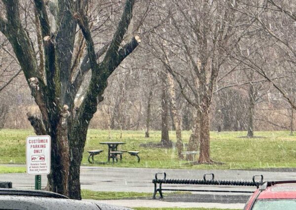
After several days of warmer temperatures, Alexandria is experiencing weather whiplash as snow falls today (Thursday).
Rain has turned to a mix of snow and rain in the early afternoon. The National Weather Service says the brief snowfall could become heavy at times.

Snowfall has started in Northern Virginia, with about an inch or less of accumulation predicted throughout the rest of the day Monday, according to the latest forecast from the National Weather Service.
Light snow is expected through the midday and afternoon, with the steadiest snowfall lasting through 5 p.m., according to NWS. As much as an inch of snow could accumulate at unpaved surfaces throughout the D.C. metro area, NWS said in a special weather statement issued this morning (Monday).