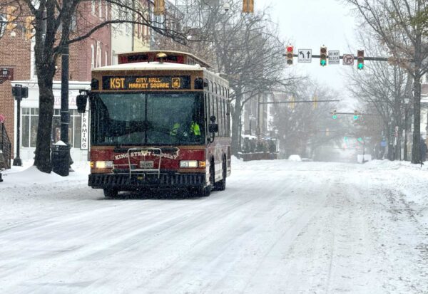
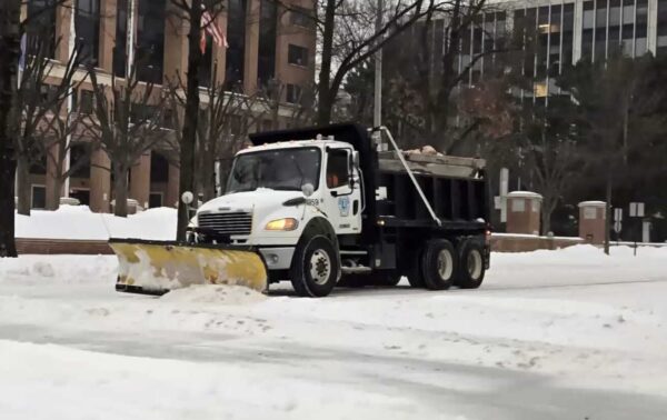
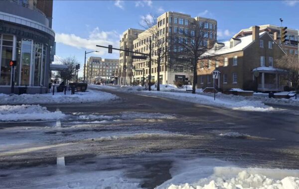
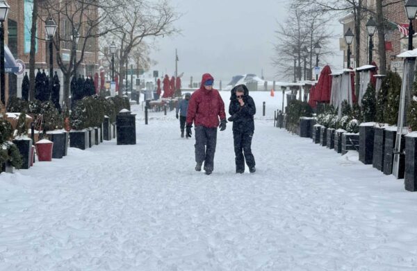
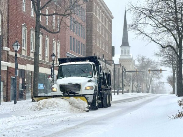
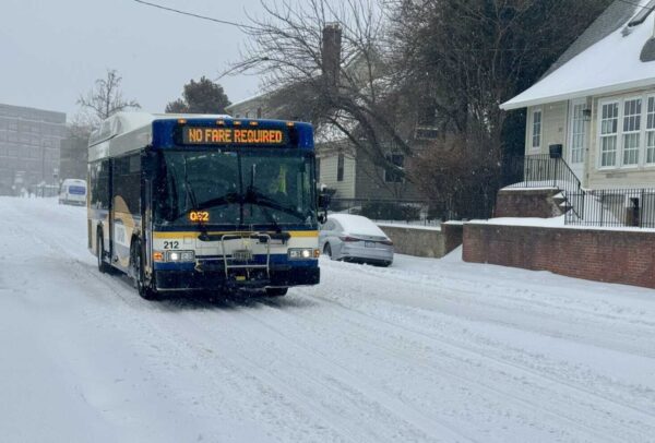
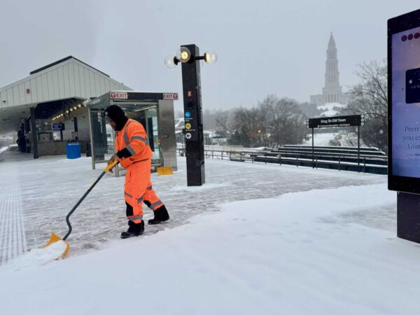
Post Content
The George Washington National Masonic Memorial under the snow, Jan. 4, 2022. (staff photo by James Cullum)

You might want to rethink any plans you made for the first weekend of the new year.

Meteorologists forecast a significant winter storm this weekend, with rain and snow kicking off sometime after 1 p.m. on Saturday, Jan. 6. The forecasts put the chance of precipitation at 80%, going up to 90% overnight.

There’s a chance of snow continuing on Sunday morning, though it should clear up by Sunday night and Monday morning.

The National Weather Service predicted an “enhanced winter storm threat” with possible closures and impacts to travel.

Alexandria had a mostly snow-less 2023, though there was a light dusting early last month.

4 Comments
A cloudy day in Old Town (staff photo by Jay Westcott)

Alexandrians traveling for the holiday should be aware the area will likely see some rain this week, but things should clear up on Thanksgiving.

The National Weather Service said rain will likely start on Tuesday after 10 a.m.

According to the forecast:

Rain, mainly after 10am. High near 54. East wind 7 to 12 mph increasing to 13 to 18 mph in the afternoon. Winds could gust as high as 29 mph. Chance of precipitation is 100%. New precipitation amounts between a half and three quarters of an inch possible.

The forecast calls for rain continuing into the night with temperatures around 48 and high winds.

On Wednesday, there’s a roughly 20% chance for rain before 10 a.m. in the area with partly sunny skies.

Thanksgiving day, however, should be sunny with a high near 55.

Rain could be returning after that, though, with a 40% chance of precipitation throughout Friday.

3 Comments
Cold front heading toward Northern Virginia (image via National Weather Service/Twitter)

Trick-or-treaters last night might have noticed a chill in the air and the National Weather Service (NWS) has confirmed it’s likely to get colder tonight.

The NWS has issued a freeze warning from 11 p.m. this evening (Wednesday) to 10 a.m. tomorrow (Thursday). The source is a cold front pushing through the region with potentially hazardous driving conditions tonight.

According to the NWS:

…FREEZE WARNING IN EFFECT FROM 11 PM THIS EVENING TO 10 AM EDT
THURSDAY…

* WHAT…Sub-freezing temperatures as low as 25 expected.

* WHERE…Portions of central, northern, northeast, and southern
Maryland, The District of Columbia, central and northern
Virginia, and the eastern panhandle of West Virginia.

* WHEN…From 11 PM this evening to 10 AM EDT Thursday.

* IMPACTS…Frost and freeze conditions will kill crops, other
sensitive vegetation and possibly damage unprotected outdoor
plumbing.

NWS said locals should take steps to protect tender plants from the cold. Outdoor water pipes should be wrapped, drained or allowed to drip slowly to prevent freezing or possible bursting. Those with in-ground sprinkler systems should drain and cover above-ground pipes.

As for whether Alexandria will have a snowy winter season, experts were mixed earlier this year on the chances for snow, with the National Oceanic and Atmospheric Administration predicting higher than-average temperatures in Northern Virginia this winter but Washington Post predicting above-average snowfall.

2 Comment
Art On The Avenue in Del Ray, Nov. 12, 2022 (staff photo by James Cullum)

Del Ray’s biggest celebration of the year is right around the corner.

Thousands are expected to descend on Mount Vernon Avenue to see the work of more than 300 artists for the 28th annual Art on the Avenue on Saturday.

The free family friendly event is located on Mount Vernon Avenue between Hume and Bellefonte Avenues, and will run from 10 a.m. to 6 p.m.

Last year’s event was postponed a month due to rain. This year, there’s a 60% chance of rain on Saturday before 8 a.m., and otherwise the forecast calls for a partly sunny day with a high of 67 degrees and wind gusts of up to 25 miles per hour, according to the National Weather Service.

The event will also feature live music on three stages, a pie baking contest, as well as a kids corner to create art at Pat Miller Neighborhood Square. The kids corner is sponsored by Dominion Energy, which was lambasted in 2021 by City Council for an all-day power outage during that year’s event.

Parking is expected to be limited, and the city is offering free trolley transportation from the Braddock Road Metro station.

2 Comment
Expected tropical storm track (via National Weather Service)

Alexandrians should brace for a stormy weekend.

Rain is likely to kick off tonight after 11 p.m. and there’s a good chance it will continue through the weekend as a tropical storm approaches Saturday night, according to the National Weather Service.

Tropical storm conditions are possible Saturday night. Between 1 and 2 inches of rainfall is expected.

“Widespread rainfall amounts of 2 to 4 inches are expected, with localized amounts up to 5 inches possible,” the National Weather Service said in an advisory today. “This may result in isolated instances of flooding, especially for low lying and flood prone areas. The heaviest rain is most likely to occur Saturday into Saturday night.”

Some of that rain is expected to continue into Sunday, with showers before 8 a.m.

The storm’s already had an impact on some Alexandria events. The first “Rock the Block” for the Eisenhower Corridor is being postponed thanks to the storm.

Sandbags are also being distributed for Old Town Businesses today from 2-3 p.m.

5 Comments
The Eisenhower Rock the Avenue Block Party is on Saturday, Sept. 23, 2023 (courtesy image)

(Updated on Sept. 21) This Saturday’s first-ever Eisenhower Rock the Avenue Block Party to promote the Eisenhower Valley has been postponed due to a rainy forecast.

“As of this morning, it is still calling for 100% heavy rain and high wind,” event organizers wrote in an email. “Given these predictions, it would be very hard to hold an event with these miserable conditions.”

Eisenhower Partnership and SaltBox are hosting the inaugural event, which was to include a pop-up Cider Garden hosted by Lost Boy Cider, food and products from businesses on Eisenhower Avenue, as well as kid-friendly activities and live music.

A replacement date has not been announced.

0 Comments

Stay cool and keep hydrated; the National Weather Service said it’s going to be a hot day in Alexandria.

The heat advisory has been issued for noon to 8 p.m. today. Heat index values are expected to reach 100 and 105 across the region.

The National Weather Service advised those in the region to drink fluids, stay out of the sun, and check up on relatives and neighbors who might need help.

According to the National Weather Service:

Drink plenty of fluids, stay in an air-conditioned room, stay out of the sun, and check up on relatives and neighbors. Young children and pets should never be left unattended in vehicles under any circumstances. Take extra precautions if you work or spend time outside. When possible reschedule strenuous activities to early morning or evening. Know the signs and symptoms of heat exhaustion and heat stroke. Wear lightweight and loose fitting clothing when possible. To reduce risk during outdoor work, the Occupational Safety and Health Administration recommends scheduling frequent rest breaks in shaded or air conditioned environments. Anyone overcome by heat should be moved to a cool and shaded location. Heat stroke is an emergency! Call 9 1 1.

2 Comment
Flood watch issued (image via City of Alexandria/Twitter)

At the risk of flooding readers with stormwater stories today, locals recovering from last night’s flooding should be aware there’s a chance for more tonight.

A flood watch is different from a flood warning, but it’s of particular note coming to quickly after the last storm.

The City of Alexandria said there could be up to two inches of rainfall with excessive runoff in flood-prone locations around town.

The flood watch, ironically, overlaps with the start of a meeting about putting more resources into a flood mitigation grant program.

If you’re looking for something to tide you over until the weather passes, Port City noted that it has cases of Derecho beer in stock — a throwback to an interesting bit of local stormy brewing history.

0 Comments

Good Tuesday morning, Alexandria!

☀️ Today’s weather: The weather forecast for Tuesday is mostly sunny with a high temperature of around 84 degrees, accompanied by a breezy west wind blowing at 14 to 20 mph, and gusts reaching up to 26 mph. Tuesday night will be mostly clear with a low temperature of about 67 degrees, and a west wind blowing at 6 to 13 mph, with gusts as high as 22 mph.

🚨 You need to know

After Alexandria was hit with a thunderstorm yesterday afternoon, the city has some relief with clear skies today.

Alexandria has also fared better in the outage department than it has in the past and better than neighboring Fairfax and Arlington. As of this morning, there are only 15 customers without power in Alexandria, compared to 221 in Arlington and 1,463 around — the admittedly much larger — Fairfax County.

Alexandria is getting a few days of reprieve. The National Weather Service said today and tomorrow should be “mostly sunny” and “sunny” respectively, though there’s a chance of showers and a lighter thunderstorm on Thursday afternoon before returning to a streak of sunny skies.

📈 Monday’s most read

The following are the most-read ALXnow articles for Aug 7, 2023.

  1. JUST IN: Tornado Watch issued for Alexandria and much of the region (3295 views)
  2. Notes: Suspect arrested after Hybla Valley shooting on Sunday (1342 views)
  3. National Weather Service warns of hazardous conditions today and tonight in Alexandria (1234 views)
  4. VIDEO: Driver arrested after Arlandria hit-and-runs Sunday morning (907 views)

🐦 Tweets of note

https://twitter.com/AlexandriaNow/status/1688657308266401792

📅 Upcoming events

Here is what’s going on today in Alexandria, from our event calendar.

  • No events today. Have one to promote? Submit it to the calendar.
0 Comments
Storm over the D.C. region (staff photo by Vernon Miles)

Update at 6:10 p.m. — There are several outages reported around Alexandria due to the storm with around 2,000 total customers affected around the city. The largest outages are currently in the Lincolnia/Landmark areas.

The much-discussed storm has finally hit Alexandria.

The National Weather Service issued a Severe Thunderstorm Warning for Alexandria and nearby localities.

There are reports of downed power lines around the city. There are downed wires near the intersection of Route 1 and Cameron Street in Old Town, per scanner traffic.

Residents are being encouraged to go to their basements or to an interior portion of a sturdy structure, away from windows. The storms have been toppling trees and knocking out power over a large swath of Fairfax County prior to their arrival here.

https://twitter.com/patpend/status/1688667205406273537

More from the National Weather Service:

BULLETIN – IMMEDIATE BROADCAST REQUESTED
Severe Thunderstorm Warning
National Weather Service Baltimore MD/Washington DC
543 PM EDT Mon Aug 7 2023

The National Weather Service in Sterling Virginia has issued a

* Severe Thunderstorm Warning…

* Until 645 PM EDT.

* At 543 PM EDT, severe thunderstorms were located along a line extending from I66 and I495 Interchange to 12 miles west of Stafford, moving east at 50 mph.

HAZARD…60 mph wind gusts.

SOURCE…Radar indicated.

IMPACT…Damaging winds will cause some trees and large branches to fall. This could injure those outdoors, as well as damage homes and vehicles. Roadways may become blocked by downed trees. Localized power outages are possible. Unsecured light objects may become projectiles.

* Locations impacted include… Arlington, Alexandria, Waldorf, Dale City, Bethesda, Bowie, Annandale, Clinton, Springfield, College Park, Fort Washington, Greenbelt, Fairfax, Langley Park, Fort Hunt, Vienna, Groveton, Forestville, Falls Church and Huntington.

PRECAUTIONARY/PREPAREDNESS ACTIONS…

A Tornado Watch remains in effect until 900 PM EDT for District of Columbia…central and southern Maryland…and northern Virginia.

For your protection move to an interior room on the lowest floor of a building.

Large hail and damaging winds and continuous cloud to ground lightning is occurring with these storms. Move indoors immediately. Lightning is one of nature’s leading killers. Remember, if you can hear thunder, you are close enough to be struck by lightning.

https://twitter.com/patpend/status/1688637003158441986

2 Comments
×

Subscribe to our mailing list