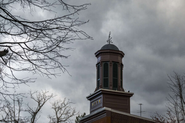
Post Content

Thousands of art lovers will have to set aside their plans this weekend, as Del Ray’s annual Art On The Avenue has been postponed due to Tropical Storm Ian.

Ian battered Florida with intensity that is now petering out and working its way up the East Coast. For Alexandria, there is 70% likelihood of rain this Saturday, and event organizers have decided not to chance a washout.

The festival will now be held on Saturday, November 12.

This is the third year in a row that Art On The Avenue has taken a hit. The 2020 festival was virtual due to the pandemic, and last year’s event was attended by thousands of people, but an unforced power outage prompted businesses along Mount Vernon Avenue to be shut down.

4 Comments
Severe thunderstorm as of 4:15 p.m.

The National Weather Service has issued both a Flash Flood Warning and Severe Thunderstorm Warning for Alexandria and surrounding localities.

“The National Weather Service has issued a Severe Thunderstorm Warning for Alexandria,” the city said in an emergency alert. “Seek indoor shelter immediately.”

In a separate Flash Flood Warning, the city said to avoid small streams and not to drive through water on roadways.

More from the National Weather Service:

BULLETIN – IMMEDIATE BROADCAST REQUESTED
Severe Thunderstorm Warning
National Weather Service Baltimore MD/Washington DC
428 PM EDT Wed Aug 10 2022

The National Weather Service in Sterling Virginia has issued a

* Severe Thunderstorm Warning for… The northwestern District of Columbia… Southeastern Montgomery County in central Maryland… Northwestern Arlington County in northern Virginia… Northeastern Fairfax County in northern Virginia…

* Until 515 PM EDT.

* At 428 PM EDT, a severe thunderstorm was located over North Bethesda, or over Rockville, and is nearly stationary.

HAZARD…60 mph wind gusts.

SOURCE…Radar indicated.

IMPACT…Damaging winds will cause some trees and large branches to fall. This could injure those outdoors, as well as damage homes and vehicles. Roadways may become blocked by downed trees. Localized power outages are possible. Unsecured light objects may become projectiles.

* Locations impacted include… Arlington, Rockville, Bethesda, Olney, Pimmit Hills, Mclean, Howard University, American Legion Bridge, Fort Totten, Aspen Hill, Potomac, North Bethesda, North Potomac, Fairland, Tysons Corner, White Oak, Redland, Takoma Park, Great Falls and Colesville.

PRECAUTIONARY/PREPAREDNESS ACTIONS…

For your protection move to an interior room on the lowest floor of a building.

2 Comment
Flood Watch boundaries (via NWS)

The National Weather Service has issued an Areal Flood Watch for Alexandria with rain expected this afternoon and most of this weekend.

While it’s clear skies this morning, the forecast for rain comes after heavy rainfall last night.

“Avoid small streams and do not drive through water on roadways,” the City of Alexandria said in a release.

From NWS:

1020 AM EDT Fri Aug 5 2022

…FLOOD WATCH IN EFFECT FROM 3 PM EDT THIS AFTERNOON THROUGH THIS EVENING…

* WHAT…Flash flooding caused by excessive rainfall is possible. […]

* WHEN…From 3 PM EDT this afternoon through this evening.

* IMPACTS…Excessive runoff may result in flooding of rivers, creeks, streams, and other low-lying and flood-prone locations.

* ADDITIONAL DETAILS…
– Showers and thunderstorms will develop this afternoon and may last into the evening. Any thunderstorms will be capable of producing very heavy rainfall, with localized totals of two to four inches possible. Much of the rain may fall within a one to three hour period, making rapid rises in creeks and streams possible, as well as flash flooding in urban areas.
– http://www.weather.gov/safety/flood

PRECAUTIONARY/PREPAREDNESS ACTIONS…

You should monitor later forecasts and be prepared to take action should Flash Flood Warnings be issued.

0 Comments
Water Levels at Cameron Run on July 9 (image via City of Alexandria)

A storm that postponed the city’s birthday celebrations last month set a rainfall record in Alexandria according to a floodwater mitigation newsletter prepared by the city.

The Flood Action Alexandria newsletter, prepared by Flood Action Alexandria communications specialist Amanda Dolasinski, noted that a storm on July 9 set the record for rainfall recorded before 7 a.m. The newsletter said the city saw nearly 4 inches of rainfall in the northeast section of Alexandria and pushed Four Mile Run to to the 10-foot stage at Shirlington Road Bridge.

“The Four Mile Run rain gauge in the northeast part of the City recorded 3.92 inches of rain at the 24-hour mark of the July 9 storm, with most rainfall recorded before 7 a.m.” the newsletter said. “The storm was classified as a 10%- to 12%-chance-per-year storm, meaning the rainfall produced exceeded the probability with a 10% chance of being equal in any given year.”

Despite the quantity of rainfall, the newsletter said the intensity was less dramatic and the city didn’t see the same levels of severe flooding as it has in the past.

“Fortunately, the intensities were less dramatic than in past large storm events,” Brian Rahal, a civil engineer for the Stormwater Management Division, said in the newsletter. “It appears the urban flash flooding was at a minimum.”

2 Comment
The National Weather Service issued a Severe Thunderstorm Watch in the area through 10 p.m. (via National Weather Service)

Alexandria and areas nearby are under a Severe Thunderstorm Watch this evening and a Flood Watch.

The National Weather Service issued a Flood Watch earlier today (Monday), cautioning flooding may occur this evening and a Severe Thunderstorm Watch is in effect until 10 p.m.

“Excessive runoff may result in flooding of rivers, creeks, streams, and other low-lying and flood-prone locations,” the Flood Watch reads. “Afternoon to evening showers and thunderstorms may produce very heavy rainfall capable of flash flooding. This could include multiple rounds of storms which would enhance the flood risk. Rainfall rates may reach 1 to 2 inches per hour, locally higher in spots. The D.C. and Baltimore metros will be the most susceptible given recent heavy rainfall the past couple of weeks.”

The National Weather Service advises residents to monitor forecasts and be prepared in case of flash floods.

2 Comment
Rain barrel (photo via Waldemar Brandt/Unsplash)

The City of Alexandria has a handful of irons in the fire when it comes to stormwater management, but one new approach is one of the oldest tactics: storing runoff in rain barrels.

The city announced yesterday that it’s planning to offer a limited supply of free rain barrels, with more available via raffle at the city libraries.

“The City of Alexandria Transportation and Environmental Services (T&ES) Stormwater Management Division will be offering a limited supply of free rain barrels to residents living in the City,” the city said in a release. “Complete the application form by July 31 to register for a free rain barrel. Additionally, a limited number of rain barrels will be reserved for raffles at each of the four library branch locations in the City.”

Those hoping to get a rain barrel must be city residents and have to demonstrate how and where the barrel will be used — presumably to collect rainwater.

“The City encourages the use of rain barrels which capture and store runoff from roofs that would otherwise be directed into the storm sewer network,” the release said.

The city said additional benefits include collecting water to use in gardening and the user is eligible for a credit towards the stormwater utility fee for installation and proper use of a rain barrel — the latter incentive is particularly relevant with stormwater utility fees going up this year.

“This program is in partnership with the Northern Virginia Rain Barrel Partnership Program, sponsored through the Northern Virginia Soil and Water Conservation District,” the release said. “The Partnership hosts build-your-own rain barrel workshops throughout the Northern Virginia area.”

https://twitter.com/AlexandriaVATES/status/1542221401582698501

Photo via Waldemar Brandt/Unsplash

3 Comments
Person running for cover in the rain (staff photo by James Cullum)

(Updated 3:40 p.m.) Keep an eye on the skies: Alexandria is under a severe thunderstorm watch and a flash flood warning.

“The National Weather Service has issued a Flash Flood Warning for Alexandria,” the city said in a release. “Avoid small streams and do not drive through water on roadways.”

Rain has started to fall around the city. The last big storm brought in severe power outages in late May. Dominion Energy warned of more outages as the year moves into hurricane season, though none are reported around the city yet as of 3 p.m.

The severe thunderstorm watch is in effect until 9 p.m.

0 Comments

After a Sunday storm that knocked out power to much of the city, some locals suggested Dominion Energy look into undergrounding more of its utilities, but the power company says costs and other factors keep that from being a viable option on a city-wide scale.

Alan Bradshaw, vice president of strategic partnerships for Dominion Energy, said commissioned studies found the cost of undergrounding all utilities to be “outlandish.”

Northern Virginia Magazine previously reported that the price tag for state-wide undergrounding is around $80 billion.

“Undergrounding is frequently brought up, especially during storms,” Bradshaw said. “The state corporation commissioned a study but installation cost is outlandish and would impact customers and their bills.”

Instead, Bradshaw said Dominion has been “strategically undergrounding” to protect some of the more vulnerable power lines.

“We took the opportunity a few years ago, not to underground everything, but to underground some of the more outage-prone lines,” Bradshaw said. “We use ten-year outage histories to identify most outage-prone lines and target the neighborhood lines we go to frequently. We’re undergrounding that for much less cost than undergrounding the entire system.”

Bradshaw did note that undergrounding isn’t viable in every location and — while not citing Alexandria specifically — did say areas that are prone to flooding also make poor candidates for utility undergrounding.

“Of course, not every area is perfect for undergrounding,” Bradshaw said. “If an area is prone to flooding, that’s probably not something we’d do there.”

Meanwhile, Dominion Energy is warning more outages are likely as the year moves into hurricane season.

The National Oceanic and Atmospheric Administration has said conditions are ripe in the Atlantic Ocean for a busy hurricane season.

“The forecast is that we do expect a busy tropical season,” said Alan Bradshaw, vice president of strategic partnerships for Dominion Energy. “The setup is conducive for some of those tracks to come up the coast.”

Bradshaw said Dominion has been upgrading its storm infrastructure, though in ways that may not be immediately apparent to someone driving past. Wooden cross arms, for example, are bein replaced with a lighter but more durable polymer.

“There’s bigger poles, stronger cross arms… a lot of new technology on the grid,” Bradshaw said. “A lot of folks that may drive down the road may see poles and wires and it may look similar to what it did 60 years ago, but there’s a lot of new technology [like] devices that monitor and tell us when there’s damage.”

Bradshaw said recovery efforts prioritize critical infrastructure like hospitals and 911 facilities. Dominion also works in tandem with local agencies on public safety hazards like downed wires.

For locals, Bradshaw said the best thing they can do to help with storm recovery is to report outages, either through an app or through the city website.

The power outages this week were met with frustration from the community.

Dominion Energy has previously told the City Council that it would invest $17 million into infrastructure in Alexandria over the next three years as part of an effort to improve reliability, though this pledge was met with some frustration from city officials at the meeting for failing to include any details on what type of improvements that investment entails.

“It’s important to know: our teams are constantly training to be the best when our customers need us most,” Bradshaw said. “When the product we provide is not available it causes issues for our customers. We’re very sensitive to that and motivated on that to get the lights on.”

15 Comments

A severe thunderstorm warning has been issued for Alexandria and the city is starting to see heavy rainfall.

The city is also under an areal flood watch.

“The National Weather Service has issued an Areal Flood Watch for Alexandria,” the city said in a release. “Avoid small streams and do not drive through water on roadways.”

The thunderstorm warning comes almost a week after a severe thunderstorm knocked out power to portions of the city until Monday afternoon.

From the National Weather Service:

BULLETIN – IMMEDIATE BROADCAST REQUESTED
Severe Thunderstorm Warning
National Weather Service Baltimore MD/Washington DC
1147 AM EDT Fri May 27 2022

The National Weather Service in Sterling Virginia has issued a

* Severe Thunderstorm Warning …

* Until 1230 PM EDT.

* At 1146 AM EDT, severe thunderstorms were located along a line extending from Lansdowne to near Chantilly to near Lake Ridge, moving northeast at 40 mph.

HAZARD…60 mph wind gusts.

SOURCE…Radar indicated.

IMPACT…Damaging winds will cause some trees and large branches to fall. This could injure those outdoors, as well as damage homes and vehicles. Roadways may become blocked by downed trees. Localized power outages are possible. Unsecured light objects may become projectiles.

* Locations impacted include… Arlington, Alexandria, Germantown, Centreville, Rockville, Bethesda, Gaithersburg, Reston, Annandale, Clinton, Olney, Springfield, College Park, South Riding, Fort Washington, Herndon, Greenbelt, Fairfax, Langley Park and Beltsville.

PRECAUTIONARY/PREPAREDNESS ACTIONS…

A Tornado Watch remains in effect until 200 PM EDT for District of Columbia…central Maryland…and northern Virginia.

For your protection move to an interior room on the lowest floor of a building.

A Tornado Watch remains in effect until 200 PM EDT for District of Columbia…central Maryland…and northern Virginia.

2 Comment

Updated at 11:15 p.m. It took nearly five hours for the power to turn back on for thousands of Alexandria residents on a steamy Sunday night (May 22).

Alexandria got hit by a severe thunderstorm at around 6 p.m. At 8:36 p.m., Dominion Energy tweeted that there were more than 25,000 homes still without power in Northern Virginia.

According to Dominion Energy’s Outage Map:

  • More than 1,300 residents experienced an outage in the Rosemont area
  • There were about 2,600 outages in the Arlandria area

Jesse Thompson lives in a high rise Arlandria, and had no power or water for five hours.

“I’m doing about as well as I can right now,” Thompson said during the outage. “This is really something else.”

After a few rocky years outage-wise, Dominion has recently pledged to invest millions in Alexandria.

City Councilman Kirk McPike tweeted that Dominion Energy’s service “continues to be unacceptable.”

0 Comments
×

Subscribe to our mailing list