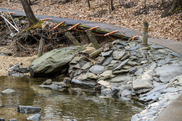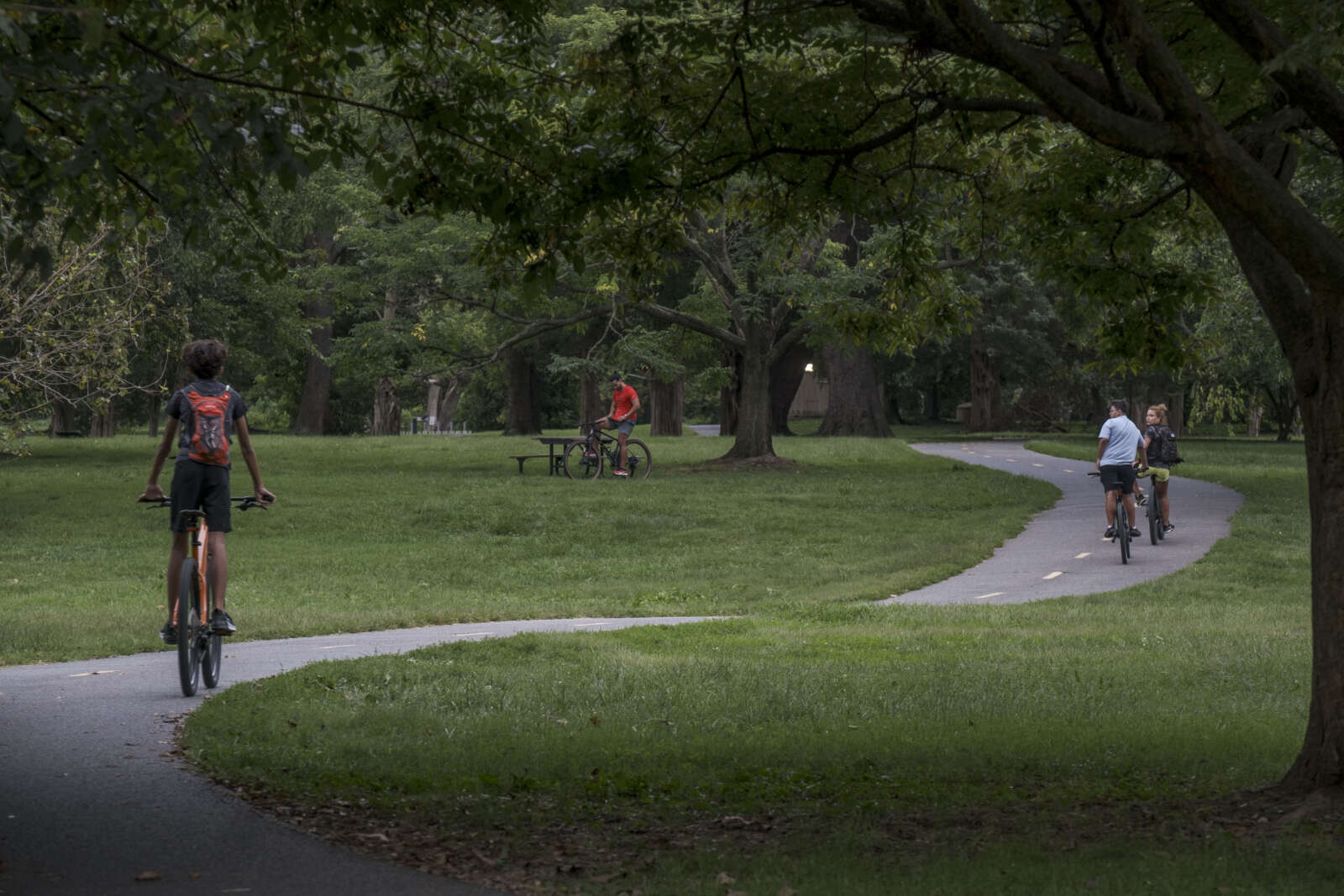
Plans to narrow the George Washington Parkway and widen the Mount Vernon Trail cleared another hurdle this week.
The changes could be coming to the Mount Vernon Trail just south of Alexandria. The National Park Service issued a Finding of No Significant Impact for an Environmental Assessment (EA) evaluating the impacts of the proposed changes, according to a release.
From where the trail leaves Old Town down to the eponymous Mount Vernon it will be widened from 8 or 9 feet wide to 10 or 12 feet wide in some areas. Four trail bridges will also be replaced.
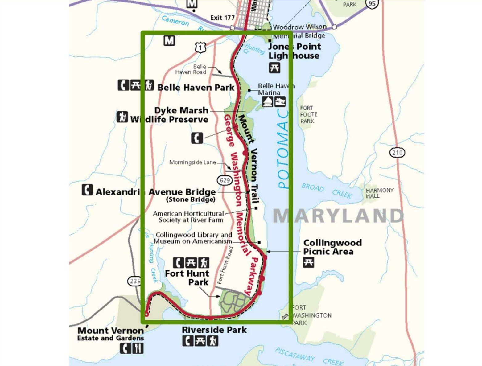
According to the release:
The EA analyzed several alternatives, including a no-action alternative and multiple action alternatives for improvements. After a period of public review and carefully considering the public comments received, the NPS selected a specific alternative that will not significantly affect the environment and encompasses a series of vital enhancements:
- Upgraded pedestrian and cycling paths to improve user safety and enjoyment.
- Enhanced road safety features, such as improved signage and lane adjustments to ensure smoother traffic flow and reduce accidents.
- Maintenance upgrades to preserve the historic and scenic integrity of the parkway and trail, including repairs to existing infrastructure and scenic overlooks.
For the road diet, the plan is to bring the parkway down to one southbound travel lane and one northbound travel lane for much of the route with a striped median or center turn lane.
Design work and planning is scheduled to start later this year.
The Friends of the Mount Vernon Trail is rallying support to get a section of roadway into Old Town North converted into a bike lane.
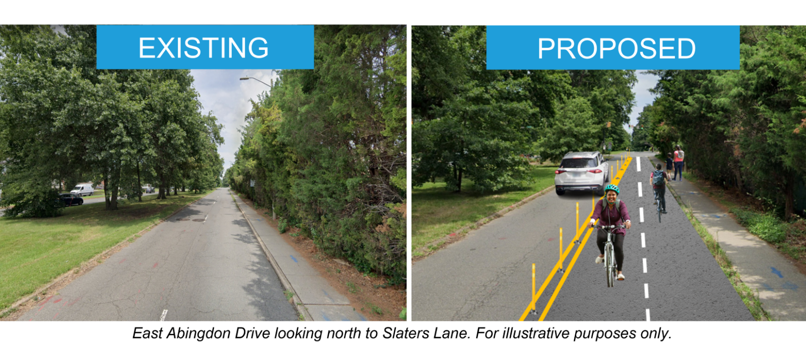
The plan would be to take the right lane of East Abingdon Drive — which runs parallel to the George Washington Memorial Parkway — and convert it into a two-way buffered cycletrack connected to the Mount Vernon Trail, Patch first reported.
The Mount Vernon Trail branches just north of Old Town, with one part continuing along the waterfront and the other leading onto E. Abingdon Drive. The section on East Abingdon Drive, however, requires cyclists to either ride in the street or on a narrow sidewalk.
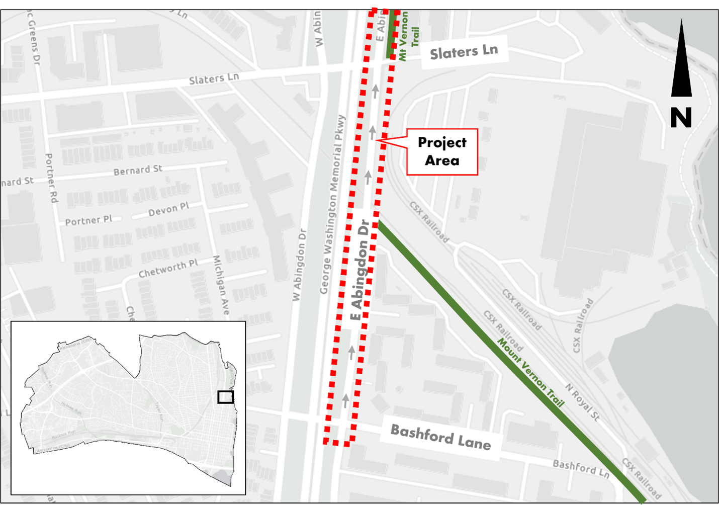
“Currently, trail users are advised to use the narrow 4-foot wide sidewalk,” Friends of the Mount Vernon Trail wrote. “On one side, is two lanes of automobile traffic, on the other is a row of cedar trees. Two trail users can not comfortably pass each other in such a narrow space. While northbound cyclists can legally use the street, southbound cyclists would be going against traffic.”
Bike lanes are also being considered at King Street near the Bradlee Shopping Center, on Eisenhower Avenue, and on Holland Lane.
Feedback on the proposal can be submitted online by Sunday, Sept. 17. The project is headed to the Alexandria Traffic and Parking Board on Oct. 23.
Help improve the Mount Vernon Trail by letting the city of Alexandria know that you support Option 2 of the East Abingdon Drive Bike Lane Project. Provide feedback by September 17
Read more here: https://t.co/VzqWBscJFX pic.twitter.com/lHUCzMoVfu— Friends of the Mount Vernon Trail (@MtVernonFriends) September 10, 2023
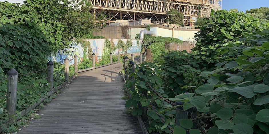
Anyone who has traveled along the Mount Vernon Trail can tell you the kudzu near the old GenOn power plant is so thick it nearly swallows the trail. Now, Friends of the Mount Vernon Trail are fighting back.
The group is organizing a pushback to the kudzu invasion on Saturday, Aug. 19 from 9-11 a.m. The group is meeting on the trail near 1198 N. Fairfax Street.
Volunteers will be using pruners and loppers to remove the vines, as well as hauling away vegetation and fallen tree branches.
Volunteers should bring water, long sleeve shirts and long pants. Volunteers should bring gloves, pruners and loppers if they have them, but some will be available to borrow.
https://twitter.com/MtVernonFriends/status/1692491825553023072
The City of Alexandria could be prioritizing the Mount Vernon Trail at crossings where, currently, trail users are expected to stop for car traffic.
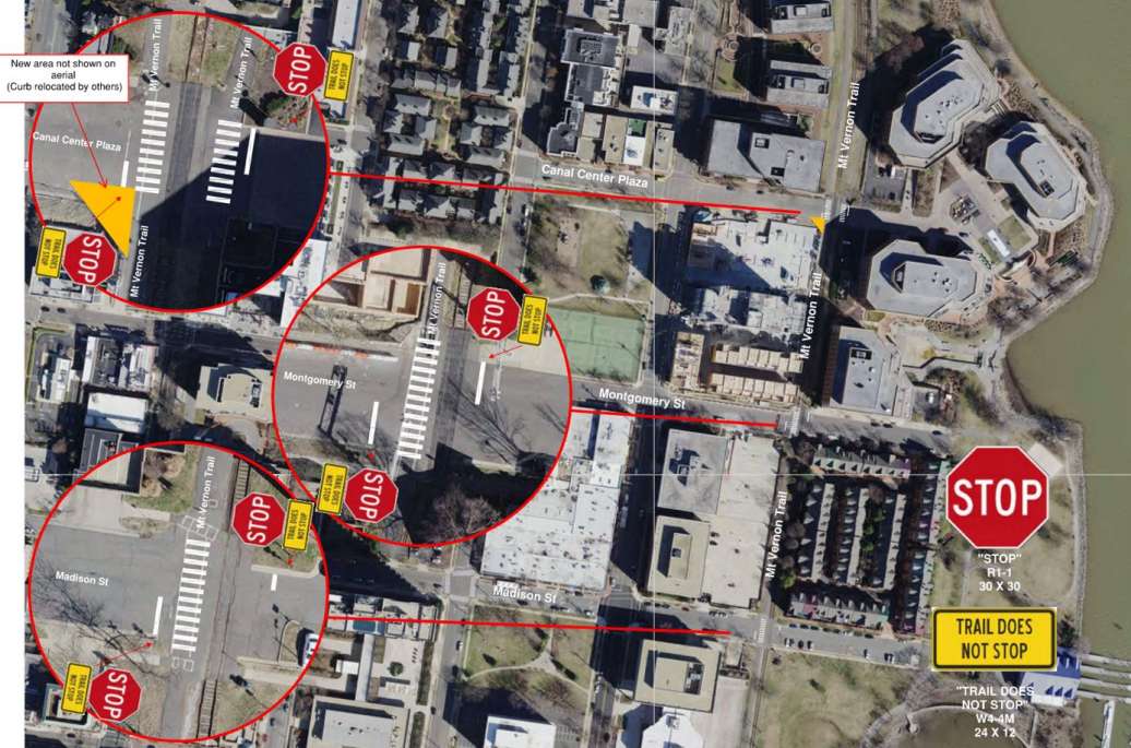
At a Traffic and Parking Board meeting last week, civil engineer Dan Scolese presented plans to change the stop signs from making pedestrians and cyclists stop for street traffic to having cars stop for trail users.
“The unusual nature is because it’s a trail and a street crossing, but the trail is considered a road,” Scolese said. “We gathered volumes during the fall. In all conditions, the trail was always more [used] than the crossing street. The split is usually more than 70%. On weekends there’s a vast difference in terms of volume on the trail.”
Scolese said trail usage at the intersections is usually pretty evenly balanced between pedestrians and cyclists.
The recommendation, supported unanimously by the Traffic and Parking Board, is to change the stop signs to face street traffic where the trail intersects at Canal Center Plaza, Montgomery Street and Madison Street, allowing trail users to continue through that part of Alexandria without stopping. The Traffic and Parking Board members did say, however, that city staff should reach out to nearby civic associations, who were not consulted ahead of the meeting.
Some on the Board said this could be the start of a broader look at how stopping is prioritized at other places where trails intersect with Alexandria streets, depending on how this goes.
“I’m curious to see how this works,” said Traffic and Parking Board chair James Lewis. “Not asking you guys for a report, but once stuff is in, if you don’t mind sharing how it’s working because this is the first time we’ve done something like this.”
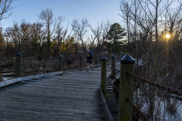
The Friends of the Mount Vernon Trail have done a lot of work on the eponymous trail, and now the group is offering a unique new way of experiencing it.
The group is hosting a “Fireflies and Bats Walk” on Saturday, June 24, from 8:45-9:45 p.m. The tour is free but attendees can get tickets and make an optional $10 donation online. The tour starts at 615 Slaters Lane.
“How do fireflies produce their glow?” the event listing asked. “Why are bats an important part of the ecosystem? Come find out on our firefly and bat walk. We’ll meet at the corner of Abingdon and Slaters Lane outside of the Salvation Army Headquarters.”
The tour includes a visit to some of the best bat and firefly watching spots along the trail and a look at a device used to identify different species of bats based on the frequency of their echolocation.
The walk is about one mile long.
Guests should bring a reflective vest and a flashlight — ideally one with a red light setting.
Experience the Mount Vernon Trail at night. Join us for a short walk on the MVT while we show you our favorite locations for bat and firefly watching. This is a kid friendly event!
🦇 : 8:45 pm
🦇 Sat June 24
Register: https://t.co/lVjVJKpDRp pic.twitter.com/IfX77UQdRJ— Friends of the Mount Vernon Trail (@MtVernonFriends) June 21, 2023
H/t to Sloane Airey
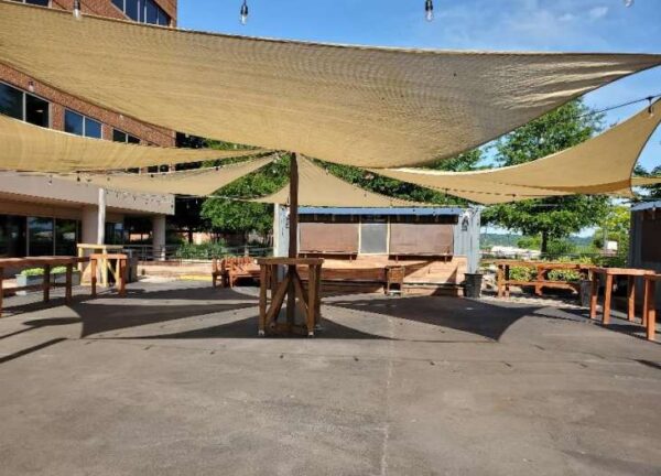
An event space just off the Mount Vernon Trail at Canal Center is looking to undergo a small expansion to make the Old Town North location a little more exciting.
Chalkboard Canal Center LLC, is proposing to add two temporary trailers to the event as well as a permit for live music to create a venue called The Bike Club.
The venue is on a 1.57-acre lot featuring 350 feet of frontage along the Mount Vernon Trail. The staff report notes that the City Council approved a zoning amendment to convert some of the office space to residential and retail use. The report says the build-out for those conversions hasn’t happened yet.
According to the application:
The applicant proposes to use two 8 by 20-foot trailers for cooking and beverage preparation within a small surface parking area adjacent to the plaza of the 99 Canal Center property. The outdoor dining area, to be known as The Bike Club, would include 60 seats and serve food and beverages, including alcohol. It would operate seven days a week and feature community events, live music, and activities such as trivia nights. Although some music may be classified as background music, the music offerings would be amplified at low levels by small public announcement equipment accommodating local singers, jazz, bands and acoustic musicians.
The location would operate Monday through Friday from 8 a.m.-10 p.m. and Friday through Sunday from 10 a.m. to midnight.
The staff report recommended approval, saying the new location could be a nice spot for cyclists, runners and pedestrians along the trail to stop. The report also said the closest residential properties are 130 feet from the venue, meaning noise impacts are likely to be minimal.
According to the report:
Staff recommends approval of the applicant’s request for temporary trailers and live entertainment at 99 Canal Center Plaza. The temporary trailers, used for food and beverage preparation, and live entertainment provide a start-up business opportunity while enlivening the outdoor plaza which is largely unused by the community and Canal Center office workers. Located just 45 feet from the Mount Vernon Trail, it would also provide a convenient food and drink stop for bicyclists, runners and pedestrians using the trail.
The project is heading to the Planning Commission on Thursday, June 22.
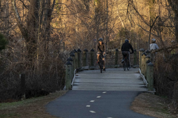
For those who haven’t bicycled or hiked the Mount Vernon Trail, there’s a new online option to explore the trail.
The Friends of the Mount Vernon Trail has mapped all 18 miles of the Mount Vernon Trail on Google Street View.
“Previously only small portions of the trail were available online,” the organization said on its website. “We hope that having the entire trail on Google Street View… will inspire people to go outside and check out the trail in real life. Additionally, people worldwide can now experience the beauty of the Mount Vernon Trail from their computers.”
The organization said the view will be updated throughout the year to see the trail change across seasons.
“We will continue to update Google Street View throughout the year so trail users can see the trail change across seasons,” the organization said. “Mapping the Mount Vernon Trail is only possible via the support of donors who helped purchase a GoPro Max camera. We use this camera to document the trail and volunteer events.”
The website features highlights from this documenting expedition, including a fitness enthusiast caught on camera doing pushups.
The Friends of the Mount Vernon Trail are starting the new year with some improvements near Daingerfield Island.
The volunteer organization, which does everything from clearing the trial to fixing bumps and other issues, is hosting an event on New Year’s Day. The work area is the trail on Daingerfield Island near 615 Slaters Lane.
This time, the work involves cleaning trash, clearing vegetation, and fixing several bumps in the trail.
For those that can’t make it in person, the organization is also raising funds to keep volunteers equipped with tools and supplies.
According to the event posting:
Volunteers may perform some of the following work:
- Using pruners and loppers to remove vegetation growing into the trail
- Using hand saws to cut tree branches
- Hauling away vegetation and fallen tree branches
- Picking up trash
What to Bring:
- Water
- Gloves (We’ll have some to borrow)
- Long sleeves and long pants
It took 5 volunteer to help move this huge limb at Belle Haven Park! 💪
Come flex your muscles at an upcoming volunteer event: https://t.co/h4sn9LtQJL
Donate to help us keep making the trail safe: https://t.co/gjFDOHYMUC pic.twitter.com/0DQcKJL6Ih
— Friends of the Mount Vernon Trail (@MtVernonFriends) December 22, 2022
In an update (page 7) prepared for a Transportation Commission meeting tomorrow night, staff outlined some of the progress made in the Complete Streets program along with a look at what’s ahead for some of the city’s most popular trails.
One of the biggest items is progress on the long-awaited Holmes Run Trail Repairs. Portions of the trail have been closed since flooding in 2019 destroyed much of the creek-adjacent infrastructure. The report for the Transportation Commission outlined what’s ahead for those repairs. Parts of that trail, the report said, could be completed by next spring.
“Design for the bridge at 4600 Duke Street is complete, and the City is in the process of awarding a contract for construction,” the report said. “Construction for this part of the project is expected to be complete by Spring 2023.”
Three other sections of Holmes Run Trail are still at the 60% design stage, the report said. The design is expected to be completed next February.
Elsewhere, the city is working on installing a shared-use path along Old Cameron Run Trail — which runs on the Alexandria side of Hunting Creek between Alexandria and Fairfax — between South Payne Street and Hooffs Run Drive.
“This project is currently at the 60% design stage,” the report said. “The City and its consultants are currently developing right-of-way plans to inform land dedications and/or easements that will be needed. This project is expected to begin construction in 2025 or 2026, after the RiverRenew project, which involves construction activity in the trail area, is completed.”
Another shared-use path will be added to North Beauregard Street in the West End between Fillmore Avenue and Berkeley Street.
“This project is currently at the 60% design stage,” the report said. “Design is expected to be complete in 2023.”
Lastly, the city is working on making some improvements to the Mount Vernon Trail, including some widening to allow for two-way bicycle traffic.
“This project will expand the existing Mount Vernon Trail north of East Abingdon Drive, where the trail is currently too narrow for two-way bicycle traffic,” the report said. “Design is currently at the 30% stage.”
Staff said this summer, the city worked on making some improvements on routes to John Adams Elementary School with the Safe Routes to Schools (SRTS) program.
“This summer, staff implemented the Rayburn and Reading Avenue Complete Streets Project,” the report said. “This project involved the completion of 14 SRTS recommendations for John Adams Elementary School. Improvements included the installation of new crosswalks, ADA curb ramps, median refuge areas, sidewalk connections, and pedestrian signage.”
Meanwhile, city staff have started working on similar plans around William Ramsay Elementary School, with design expected to start this fiscal year.
“Ramsay has 11 SRTS recommendations, only one of which has been completed to date,” the report said. “Construction is expected to take place next fiscal year.”
Along with the school-specific programs, city staff is working on curb extensions at multiple schools.
The Transportation Commission is scheduled for tomorrow (Wednesday) at 7 p.m. in the City Council workroom at City Hall (301 King Street).
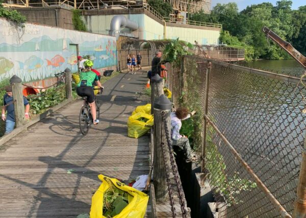
Part of the Mount Vernon Trail through Alexandria has gotten overgrown with kudzu, and locals are needed to help clear it out.
Friends of the Mount Vernon Trail posted on social media asking for volunteers to help remove it this Saturday (Aug. 27).
Those looking to help can register online.
The group’s website said they will meet near the power plant bridge near 615 Slaters Lane. Volunteers are needed to use loopers and clippers to cut vines and pull vines away.
According to the website, volunteers need to bring:
- Water
- Gloves (some will be available to borrow)
- Pruners or loopers (there will be some to borrow)
- Long sleeves and long pants
The kudzu has gotten bad on the power plant bridge in Alexandria again. Volunteer with us this Saturday as we return for our annual Kudzu removal festival.
Details and registration are at https://t.co/LOR177Zshs pic.twitter.com/pq1i0pvybp
— Friends of the Mount Vernon Trail (@MtVernonFriends) August 25, 2022


