

Increased building height allowances and new areas for housing and open space along Duke Street are among the changes Alexandria staff plan to propose in the updated Duke Street Land Use Plan.
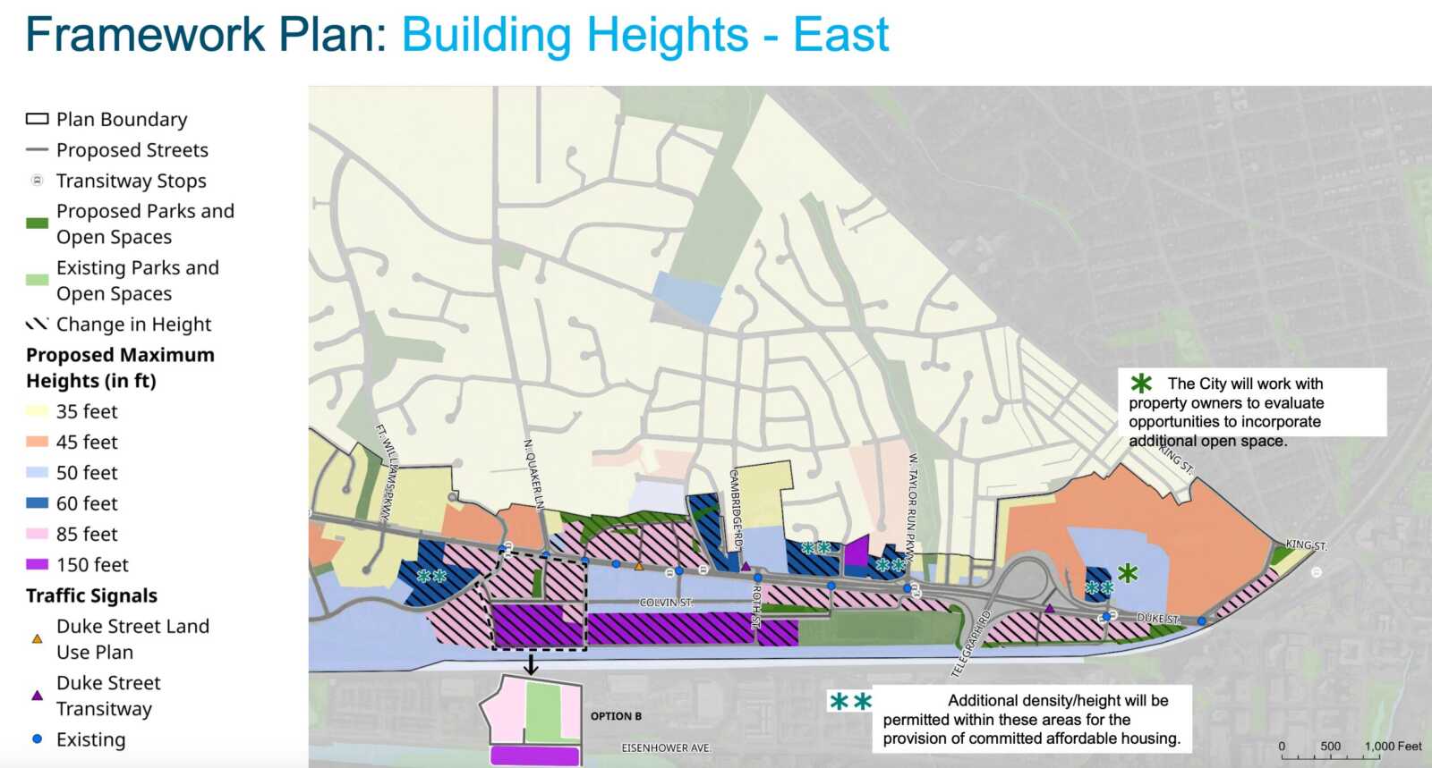
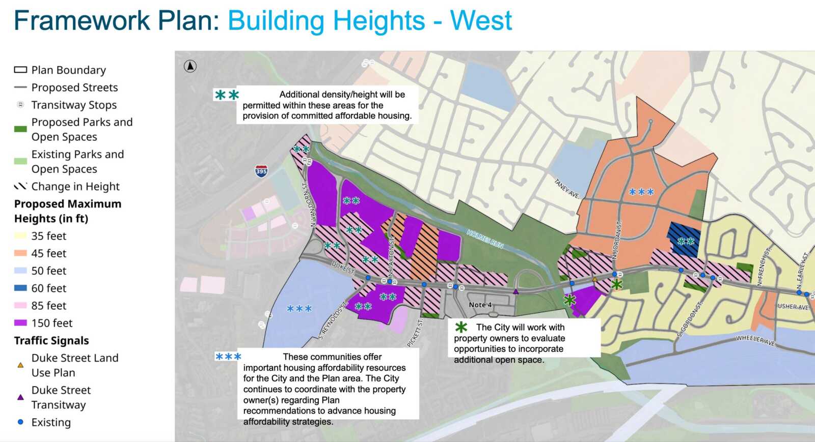
Alexandria City Council received an update Tuesday (May 26) on the plan, which will guide city officials in the development of the Duke Street corridor from the former Landmark Mall to Alexandria Union Station. The proposal includes areas deemed “opportunity sites” in industrial areas that city staff wants to redevelop, adding more housing supply and open space, with building heights of up to 150 feet.
Jeff Farmer, deputy director of the city’s planning and zoning department, listed the Alexandria Commons shopping center (3101 Duke Street) and commercial properties east of Telegraph Road as potential sites for residential development, with proposed building heights ranging from 85 to 150 feet.
“For example, Alexandria Commons, the commercial properties east of Telegraph [Road], where the postal facility is today — we’re talking to them and other owners,” Farmer said.
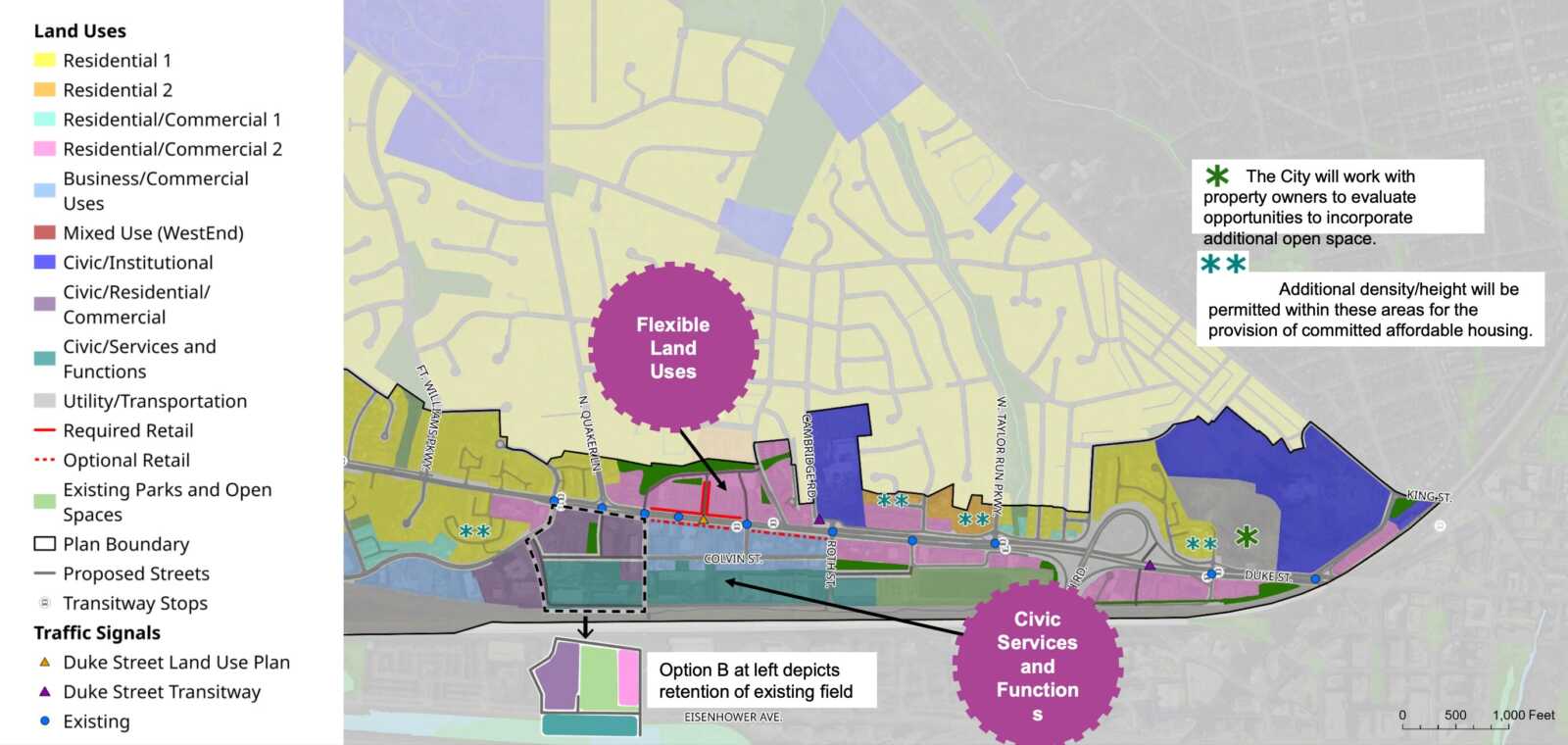
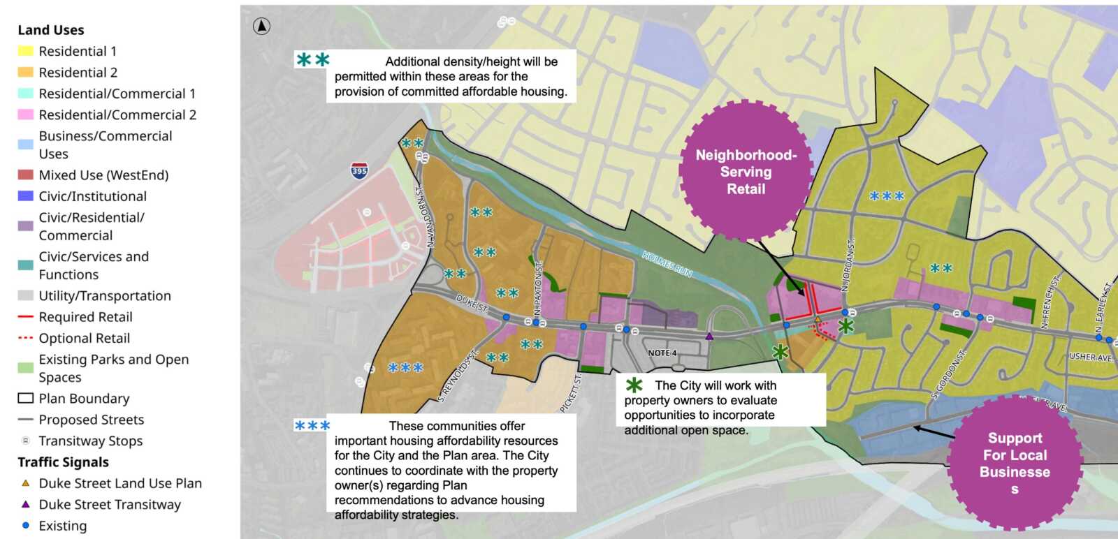
The plan also includes retail areas where additional density and height will be allowed in exchange for committed affordable housing.
“Really incentivizing development in these commercial areas results in no displacement of existing residents,” Farmer said. “It also gives us housing supply and net new affordable housing, so when that new development comes online, one of the recommendations will be a certain percentage of that be affordable.”
Mayor Alyia Gaskins said the plan needs to better account for open space in areas slated for additional housing.
“In the two areas where we’re trying to bring the most housing, we don’t have a star (in the map) that says we’re also going to look for additional open space,” Gaskins said. “I recognize there are trade-offs, and we can’t get everything with each development, but I would imagine, given what we know from Covid and other things, bringing more people, we want to have more space for them to be able to go outside.”
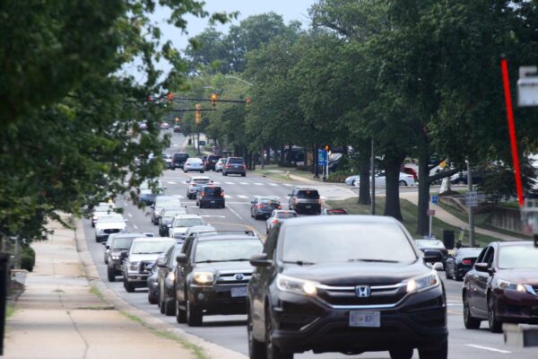
City Councilman John Taylor Chapman said city staff should evaluate creating more cut-throughs from Duke Street to the Eisenhower Avenue corridor, acknowledging that drivers heading east to west on Duke Street face significant traffic.
“That four- or five-block backup of cars is a strong challenge to grid expansion,” Chapman said. “The thickness of cars during any part of the day, any day of the week continues to be a current challenge, and I have no doubt if we are looking at additional development, not only within the corridor, but of course in and around the corridor as well, and that will continue to be a challenge.”
Farmer said incorporating that idea into the plan would delay its implementation, and that a connector would need to be part of a separate conversation.
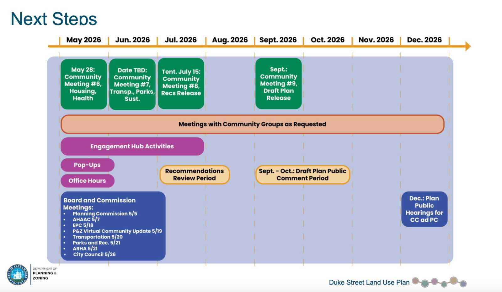
The Duke Street Land Use Plan is expected to go to the Planning Commission and City Council for public hearings and a decision in December, following a public comment period in September and October.
By the time the document is adopted, a number of major projects along Duke Street will be open or nearing completion. The first buildings in the sprawling WestEnd development are expected to open this year, followed by the opening of the anchoring Inova Alexandria Hospital at Landmark in 2028.
As part of the land use update, the city launched the Duke Street Business Passport Program, a challenge for residents to visit the most participating Duke Street businesses to win gift cards.
The city’s draft guiding themes for the Duke Street Land Use Plan are:
Overall
In all of these principles, ensure that community members of all ages, abilities, backgrounds, and needs are welcomed and included, in a community where community health and well-being are fostered.
Land Use + Design
- Create walkable neighborhoods with a mix of land uses, public spaces, streetscapes, and services.
- Ensure that new development is well-designed and enhances the corridor.
- Ensure that new development enhances access to neighborhood retail, civic uses, transit options, and community focal points.
- Prioritize uses that serve the daily needs of the residents.
- Promote economic opportunities and the retention and growth of small businesses.
Mobility + Safety
- Provide safe ways for people to get around along the corridor.
- Create a well-connected system of streets, alleys, sidewalks, and trails that makes it easier to get around.
- Support a variety of travel choices—including walking, biking, transit, and driving—while encouraging active and sustainable options.
- Incorporate current and emerging technologies to enhance mobility and safety.
Parks + Open Space
- Pursue new neighborhood-serving parks and public open spaces.
- Pursue opportunities for new City-parks and public open spaces.
- Make it easier for people to connect to and enjoy existing parks and public open spaces.
- Ensure parks and public open spaces include a wide range of amenities.
Housing
- Increase the supply and diversity of housing options accessible to households of all incomes.
- Expand committed affordable rental and homeownership opportunities.
- Improve housing quality, safety, and long-term stability in existing and new development.
- Prioritize anti-displacement and preservation strategies to the greatest extent possible, including the potential preservation of existing committed and naturally occurring affordable housing.
Sustainability
- Promote a sustainable urban environment, energy-efficient buildings, and renewable energy.
- Implement green infrastructure throughout the corridor.
- Protect the corridor’s natural resources and expand the tree canopy.
- Strengthen the corridor’s resilience against the impacts of extremes in heat and cold through the design of new development, parks and infrastructure.
Health
- Ensure equitable access to services and resources that improve physical and mental and health and wellbeing.
- Provide opportunities for physical activity, community gathering areas, and social connection.
- Expand access to affordable goods and services such as food and other resources.
- Provide shade and other heat mitigation strategies in new developments, infrastructure and new and existing parks and public open spaces.
